Urban Planning in Chennai
Issues, Challenges, Potential Solutions
Introduction
History is something that engrosses me. And it is another reason, Why I choose to write and communicate. In terms of historical roots, Madras has been one of earliest trading posts established by British.
My first trip to Madras was in 2009, the city has special memories for me. My first stay in Madras was my stay in Chrompet. I only had finished high-school. I got to learn how working class men stayed in the city, made their way in Life. During this time, I did not have much money, I had a spare black and white phone, lived in a room where few college students, then bachelor working men shared. Truly, It was a humbling experience, and I look back, grateful for this time. For commuting, I took the local train, which went all the way to Chennai Beach. For someone who was fresh out of high school, this was an experience of freedom. The city had good bus stations, buses connected to all towns.
After this opportunity, I got a chance to visit towns, cities in America. This opened my eyes, I wondered why and how the towns were organized, managed, finances? And I wondered, Why is it that, not one South Indian town could match in urban planning? I truly wanted a town in South India to be world class in urban planning.
A good urban planned South Indian city is truly not for, only the wealthy, the car-owning, or the politically connected. In my view, It is for the students, workers, migrants, women, elders, children, street vendors, shopkeepers, commuters, and families. It gives life, meaning for ordinary people through access to transportation, education, healthcare, jobs, public space, safety, sanitation, and gives them dignity. As I have been exploring towns across the world, understanding urban planning, one of the concerns is inclusiveness of all in the town, who can have access to basic services as transportation, education, healthcare and access to jobs.
Weather of Chennai
For urban planning, Chennai’s weather is to be considered seriously. Otto Koenigsberger, a German-Indian architect who worked in India from 1950-1991 contributed to India’s Urban planning. His firm suggestion was context-sensitive, climate-responsive, and built around local realities rather than copy-pasting, western urban planning works. Cities should be planned flexibly, with room to adapt as conditions change, and developmental planning was way to improve living standards.
Chennai is hot, humid, coastal, monsoon-dependent city. Its planning system needs to respond to heat, intense seasonal rainfall, flooding, cyclones, coastal exposure, and seismic safety. Chennai is in Seismic Zone III, which is a moderate damage risk zone. This means that buildings, bridges, hospitals, schools, metro structures, water-supply systems, and other[12] critical infrastructure should follow earthquake-resistant design standards. [13].
Chennai’s regular planning challenge is heat and monsoon rainfall. According to the India Meteorological Department’s 1991–2020 climatological table for Chennai Nungambakkam, May and June have average daily maximum temperatures of about 37.3°C and 37.2°C respectively. On extreme days, temperatures can cross 40°C. Even the cooler months are mild rather than cold. January’s average daily minimum is about 21.5°C, and the average daily maximum is about 29.7°C [14].
Rainfall is central to Chennai’s urban planning problem. IMD’s 1991–2020 normal for Chennai Nungambakkam gives an average annual rainfall of about 1,376.8 mm, or roughly 138 cm / 54 inches. The rainfall is not evenly distributed across the year. The heaviest months are during the Northeast Monsoon, especially October, November, and December. IMD records normal rainfall of about 300.3 mm in October, 373.6 mm in November, and 182.4 mm in December [14].
Because Chennai is a coastal city on the Bay of Bengal, cyclone-related hazards are to be considered. IMD’s cyclone hazard climatology evaluates coastal districts using factors such as cyclone frequency, severe cyclone frequency, maximum wind strength, probable maximum storm surge, and probable maximum precipitation. For Chennai, this means that urban planning cannot treat rain, drainage, coastal flooding, and emergency infrastructure as separate issues [15].
For Chennai, the major environmental planning risks can be summarized as follows:
| Risk | What’s required for urban planning |
|---|---|
| Heat | Streets need shade, trees, ventilation, cool materials, and walkable public spaces. |
| Monsoon rainfall | Stormwater drains, canals, tanks, marshlands, and outfalls must function as one connected drainage system. |
| Cyclones and coastal exposure | Coastal infrastructure, housing, roads, power systems, and emergency services must be planned for wind, storm surge, and extreme rainfall. |
| Moderate seismic risk | Buildings and infrastructure should follow earthquake-resistant standards, especially schools, hospitals, bridges, metro systems, and high-occupancy buildings. |
Therefore, Chennai’s environmental risk is a combined urban planning problem that is facing heat, monsoon flooding, coastal hazard and moderate seismic risk.
A world-class Chennai’s planning requires to be a climate-resilient city where buildings, roads, drains, tanks, wetlands, canals, parks, trees, transport systems, power systems, and emergency infrastructure are designed together.
Who manages Chennai’s planning and upkeep?
Chennai’s planning, construction, and maintenance are not handled by a single authority. The Chennai Metropolitan Development Authority (CMDA) is the main [16], metropolitan planning authority for the Chennai Metropolitan Area. CMDA prepares the Master Plan, regulates land use, applies development regulations, and issues or delegates planning permissions. CMDA’s planning-permission process is tied to the Tamil Nadu Town and Country Planning Act, 1971 [17].
All development applications are checked against the Master Plan, Detailed Development Plans, and Development Regulations.
| Function | Main agency | Role |
|---|---|---|
| Metropolitan planning, land use, zoning, development regulation | CMDA | Prepares the Master Plan, land-use framework, development regulations, and planning permissions for the Chennai Metropolitan Area. |
| Local civic maintenance | Greater Chennai Corporation (GCC) | Maintains local roads, street cleaning, streetlights, parks, schools, civic complaints, and local public works within GCC limits. |
| Stormwater drains and local flood mitigation | Greater Chennai Corporation (GCC) | Provides and maintains stormwater drains, canals under GCC control, desilting works, and local flood-mitigation infrastructure. |
| Solid waste management | Greater Chennai Corporation (GCC) | Handles garbage collection, transportation, processing, and disposal of municipal solid waste. |
| Water supply and sewerage | Chennai Metropolitan Water Supply and Sewerage Board (CMWSSB / Metro Water) | Responsible for water supply and sewerage services in Chennai. |
| Transport coordination | Chennai Unified Metropolitan Transport Authority (CUMTA) | Coordinates urban transport planning and prepares the Comprehensive Mobility Plan for the Chennai Metropolitan Area. |
| City buses | Metropolitan Transport Corporation (MTC) | Operates public bus services across Chennai and the wider metropolitan area. |
| Metro rail | Chennai Metro Rail Limited (CMRL) | Implements and operates the Chennai Metro Rail system. |
| Suburban rail and MRTS | Southern Railway / Indian Railways | Operates Chennai suburban rail and MRTS services. |
| Rivers, tanks, reservoirs, canals, and major waterways | Water Resources Department / PWD | Manages reservoirs, lakes, rivers, canals, river basins, and larger flood-control water systems. |
| Major roads, bridges, bypasses, and state highways | Tamil Nadu Highways Department | Builds and maintains State Highways, Major District Roads, Other District Roads, bridges, bypasses, and larger road infrastructure. |
| Electricity distribution | TNPDCL / TNEB system | Handles electricity distribution, power supply complaints, billing, and distribution infrastructure. Many people still refer to this system using older names such as TANGEDCO or TNEB. |
| Pollution control | Tamil Nadu Pollution Control Board (TNPCB) | Regulates pollution, sets standards for sewage, trade effluent, emissions, and monitors water, air, and land pollution. |
| Land records, reclassification, encroachments, and permissions | Revenue Department, CMDA, GCC, local bodies, and line agencies | Handles ownership records, land-use reclassification, local-body remarks, and NOCs from agencies such as WRD, TNPCB, and others when required. |
The result is that, one Chennai neighbourhood is depending on ten or more agencies to function properly. And there is no enforcement, accountability, overarching unit that keeps them all check, to keep operations enabled in the city. Common issue that comes up is rule based enforcement, maintenance and accountability.
CMDA decides the land-use framework and development permissions.
GCC maintains local streets, stormwater drains, streetlights, and civic infrastructure.
CMWSSB manages water supply and sewerage.
CUMTA coordinates metropolitan transport planning across agencies.
MTC operates city bus services.
CMRL operates the Metro rail system.
Southern Railway operates suburban rail services.
WRD manages canals, tanks, rivers, reservoirs, and major water bodies.
Highways Department controls and maintains major arterial roads and state highways.
TNPCB regulates pollution and environmental compliance.
Revenue authorities maintain land records and handle encroachment-related powers.
This explains why Chennai can have approved buildings but weak sewage capacity, flooding during rainy season, roads without good footpaths, stormwater drains but continued waterlogging, bus routes without comfortable bus stops, parks without proper maintenance, and land-use plans that do not match everyday street life.
Certainly, Chennai has a planning authority. However, It does not yet function coherently strictly, as one fully unified, integrated urban delivery system with accountability, enforcement.
Brief Overview of Chennai’s Urban Planning
Chennai has had many Urban planning over decades. It starts with the 1957 General Town Planning Scheme, the 1967 Interim Plan, the 1971 Madras Metropolitan Plan, the 1974 Madras Urban Development Project.
The 1975/1976 First Master Plan, the World Bank-supported MUDP/TNUDP projects, the 2008 Second Master Plan, JNNURM stormwater projects. River-restoration plans, disaster-management plans, climate plans, CUMTA transport coordination, and the 2026–2046 Third Master Plan preparation.
The official planning record begins before the 1960s with the General Town Planning Scheme for Madras City, 1957. Later documents include the Madras Interim Plan, 1967, the Madras Metropolitan Plan, 1971–1991, the Madras Urban Development Project, 1974, the First Master Plan, 1975/1976, the Structure Plan, 1980, the Second Master Plan for Chennai Metropolitan Area, 2008, transport studies, flood audits, basin-drainage projects, and the [18]ongoing Third Master Plan process [19].
Show Chennai planning documents table
| Period | Document | Type of planning | Main point | What failed |
|---|---|---|---|---|
| 1957 | General Town Planning Scheme for Madras City | City physical plan | Early attempt to guide Madras city growth. | Too limited for a fast-growing metropolitan region. |
| 1967 | Madras Interim Plan | Metropolitan physical plan | Treated Madras as a wider urban system, not just a municipal city. | Physical planning was not fully tied to finance and delivery. |
| 1971–1991 | Madras Metropolitan Plan | Long-range metropolitan plan | Covered land use, transport, water, sewerage, drainage, slum clearance, education, health, recreation, refuse collection, finance, and institutions. | Ambitious plan, but growth outpaced infrastructure and enforcement. |
| 1974 | Madras Urban Development Project | Investment/project planning | Turned planning into funded urban projects, including serviced land and infrastructure. | Encouraged project-based fixes rather than one integrated city delivery system. |
| 1975/1976 | First Master Plan | Statutory land-use master plan | Controlled land use, density, development regulations, transport, utilities, and public facilities. | The city expanded beyond the plan’s assumptions; infrastructure capacity did not keep pace. |
| 1980 | Structure Plan | Strategy correction | Recognized that earlier growth-control assumptions needed revision. | Early ideas such as cycleways and better transport integration were not built into a citywide system. |
| 2008 | Comprehensive Traffic and Transportation Study | Transport planning | Said Chennai must move people, not only vehicles; public transport, walking, and cycling needed priority. | Pedestrian and cyclist facilities remained weak; streets continued to prioritize vehicles [20]. |
| 2008–2026 | Second Master Plan for CMA | Statutory metropolitan master plan | Proposed land-use zoning, compact-city direction, transport corridors, infrastructure, environmental protection, and development regulations. | It came late after the First Master Plan period; implementation and enforcement remained weak [19], [21]. |
| 2017 | CAG Flood Management Audit | Failure audit | Found that weak planning, poor enforcement, encroachments, missing stormwater links, and poor coordination worsened flooding. | Water bodies, floodplains, tanks, canals, and drains were not protected as one urban water system [22]. |
| 2020s | Kosasthalaiyar / integrated urban flood management works | Basin-level drainage planning | Moves toward basin-based stormwater planning and macro/micro drainage improvements. | Still depends on maintenance, desilting, agency coordination, and protection from new encroachments. |
| 2026–2046 | Third Master Plan process | Next-generation metropolitan planning | Expected to address density, transport, housing, climate, blue-green infrastructure, flood risk, shoreline, economy, and institutions. | The key test is whether it becomes a delivery system, not only a new land-use map [23]. |
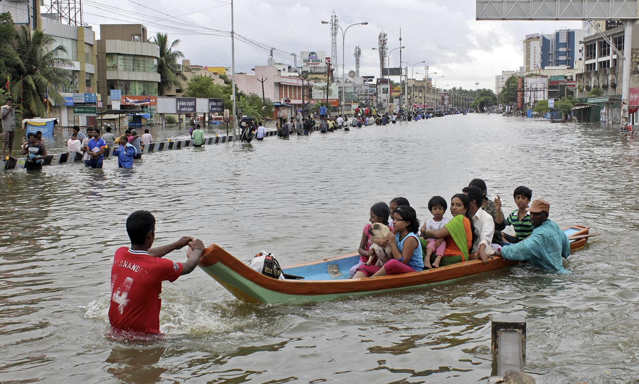
Chennai’s flooding problem
Chennai’s flooding problem is old and recurring. Official flood-monitoring material[24], CMDA/PWD drainage documents[25], and technical studies[26] identify repeated[27] major flood years, including 1943, 1976, 1985, 1996, 2005, 2015, 2021, and 2023[28]
Chennai is a flat coastal city, close to mean sea level, and drainage is affected by tides, monsoon rainfall, blocked canals, low-lying catchments, and reduced water-holding landscapes. Chennai has tried to respond to flooding, through stormwater drains, macro-drainage proposals, river desilting, canals, pumping stations, flood shelters, and disaster-management plans.
But the failures keep returning because stormwater drains alone cannot solve a basin-level problem. If canals are choked, wetlands are reduced, sewerage enters drains, river mouths are blocked, solid waste clogs channels, and development continues in low-lying floodplains, drainage projects will remain incomplete solutions.
The 2015 flood was a turning point[28] because it showed that Chennai’s flood risk[27] was not produced by rainfall alone. It was produced by the interaction[29] of extreme rainfall, reservoir operations, urbanization, development on or near water bodies, loss of wetlands and storage capacity, weak stormwater-drain networks, and fragmented governance. After the 2021 floods, Chennai accelerated larger stormwater-drain works. GCC records that the city’s expanded-area drainage planning was organized around the Adyar-Cooum, Kovalam, and Kosasthalaiyar basins, while post-2021 core-city works were sanctioned after the Thirupugazh Advisory Committee recommendations [30].
But the city’s flood response is still reactive, rather than proactive planning during crisis periods.
Chennai often treats flooding as a drainage construction problem, not as a full watershed-governance problem.
A world-class flood response would connect land-use zoning, tank restoration, marsh protection, river-mouth management, sewerage enforcement, solid-waste control, road levels, culvert hydraulics, canal maintenance, pumping capacity, flood shelters, and real-time reservoir operations into one integrated system.
Chennai neighbourhoods as case studies
To test the neighbourhood framework, I picked a few of Chennai’s most celebrated residential areas: Boat Club (Adyar / R.A. Puram side of the Adyar river) and Anna Nagar, T-Nagar, Velachery.
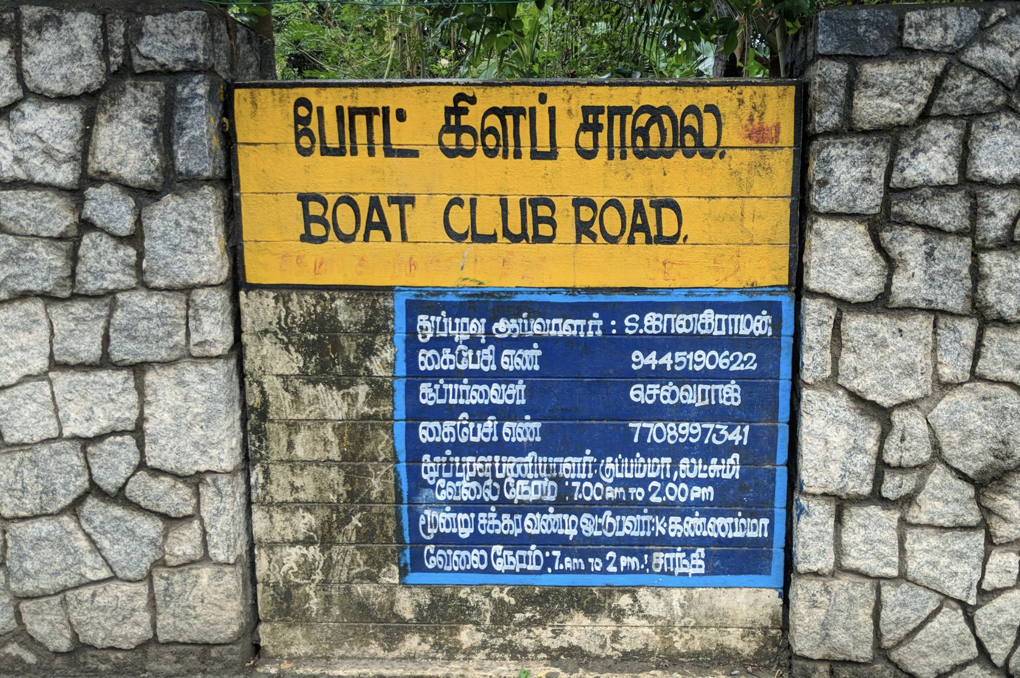
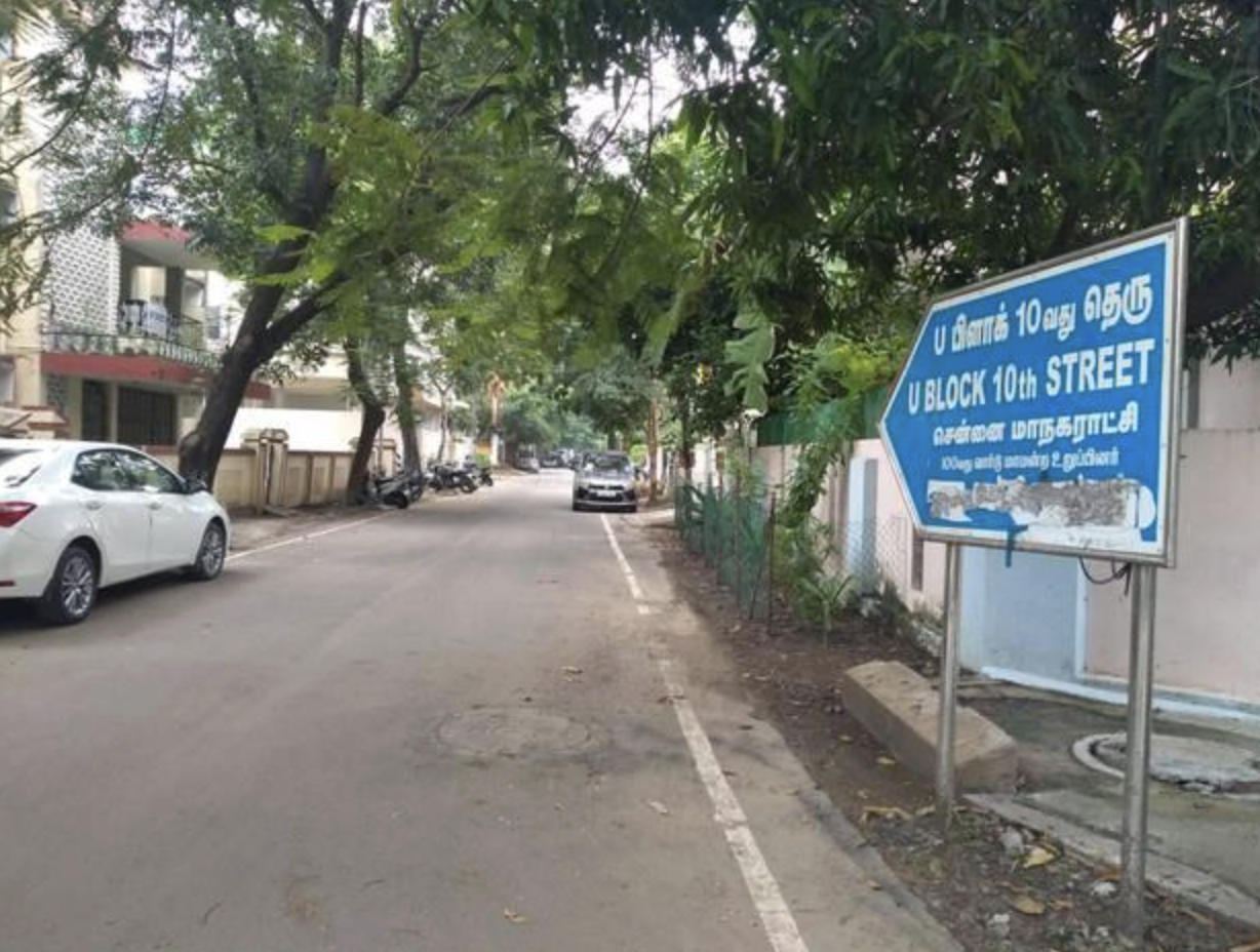
These are the among the richest, most planned, most admired addresses in South India.
The benchmark is the one this post has already set: Houten. In Houten, a child cycles safely across the whole town. In Vauban located in Freiburg, Germany, the tram, the trees, and the housing were designed as one system. Everything is accessible within 15 minutes in Houten.
The Sant Antoni Superblock (Superilla) in Barcelona, underwent a major urban transformation that converted car-centric streets into pedestrian-first spaces.
Traffic Rerouted, The city merged a 3x3 grid of traditional blocks, restricting through-traffic to the perimeter and freeing up 16,000 m² of inner street space.
Pollution Dropped: Harmful nitrogen dioxide levels decreased by 25%, and overall air pollution dropped by 17%, Noise Reduced: Local noise levels dropped by 2.5 to 4 decibels, replacing traffic sounds with community activity, Business Boosted: Despite initial merchant fears, local retail activity increased by 30% due to higher pedestrian foot traffic, Community Reclaimed Space: Asphalt was replaced with green plazas, playgrounds, and picnic seating. Over 60% of residents reported a measurable improvement in their overall well-being.
Against the above World class neighborhoods, How do Chennai’s best neighbourhoods actually perform?
Case Study 1: Boat Club, Adyar
What Boat Club is
Boat Club is Chennai’s most expensive residential address, on the northern bank of the Adyar river near the Madras Boat Club. The rowing club was founded in 1867 and later settled on the Adyar river in the late nineteenth century [31]. The neighbourhood grew out of the old Mowbrays Gardens estate, associated with Sir John De Monte and the 105-acre estate landscape between the Adyar river, Chamier’s Road, Greenways Road, and today’s Gandhi Mandapam Road [32].
The historical irony matters. The 105-acre Boat Club area was bequeathed by Sir John De Monte to the Catholic Church through a will executed on 19 July 1820, with charitable purposes for the poor, orphans, widows, distressed families, and charity schools [33]. Two centuries later, this same landscape is known less as charitable land and more as an elite enclave: industrialists, media owners, senior officials, foreign envoys, and ultra-high-value private homes. Press reports have described land values in the range of ₹15–27 crore per ground, making it one of Chennai’s most expensive residential addresses [34].
Walk through it and you see what the rest of Chennai rarely gets: broad clean roads, continuous footpaths, old canopy, low-rise homes in gardens, and streets pleasant enough that people travel from across the city just to walk there. On the surface, it is the closest thing Chennai has to a world-class residential streetscape.
But Boat Club is also a warning. A neighbourhood can be beautiful and still be weakly planned. It can have shade, calm, wealth, and prestige, while still failing as public realm, floodplain, riverfront, mixed-use neighbourhood, and enforceable climate-resilient planning system.
The standard used here is deliberately demanding. Boat Club is not being compared only with other elite inherited quarters such as Malabar Hill, Jubilee Hills, Belgravia, or Lutyens’ Delhi. It is being tested against a higher planning standard: places where land use, street life, water, shade, public access, building rules, maintenance, and governance are consciously designed and protected. That standard is demanding, but not unfair. If Boat Club claims to be Chennai’s best neighbourhood, then it should be judged not only by price and prestige, but by whether its quality is public, durable, ecological, and enforceable.
This comparison needs Indian examples. Lutyens’ Delhi is not democratic urbanism; it is colonial, monumental, low-density, and exclusionary. But it proves one important point: elite low-density urbanism can be codified. The Lutyens Bungalow Zone has been treated as a distinct planning area with special controls to preserve its green avenues, bungalow form, plot character, and low-rise setting [35], [36]. Jubilee Hills in Hyderabad shows the opposite danger. It began as a planned cooperative residential layout in the 1960s, but later commercialisation, land pressure, encroachment, and governance disputes altered its original residential character [37]. These Indian comparisons clarify Boat Club’s problem. Lutyens’ Delhi has protected form without enough democratic public life. Jubilee Hills has prestige but shows how quickly elite residential planning can be overrun by market pressure. Boat Club has inherited landscape quality, but lacks both strong statutory protection and a genuinely public neighbourhood structure.
How Boat Club falls short of world-class
1. Its excellence is inherited and accidental, not designed and protected.
Patrick Geddes argued that planning must begin with a careful study of place, work, and folk before drawing schemes [38]. By that standard, Boat Club is not the result of a deliberate neighbourhood plan. Its excellence comes from inheritance, the old Mowbrays Gardens estate, large plots, deep setbacks, private gardens, and mature trees. These produced shade, quietness, drainage capacity, and visual dignity over time.
Now, that inheritance is real and oftentimes, the mistake people might make is to confuse inheritance with planning.
Compare this with Lutyens’ Delhi. The Lutyens Bungalow Zone is also elite, low-density, and exclusionary, so it should not be romanticized. But its physical character is not accidental. Its wide avenues, large plots, bungalow form, green setting, and restrictions on redevelopment have been treated through formal planning norms. Official development-control material for the LBZ explicitly aimed to maintain the character of Lutyens’ Delhi, described through its green areas, avenues, and bungalow pattern [35].
Boat Club has similar visible qualities: shade, garden plots, low-rise buildings, and quiet streets. But it does not have a comparable conservation regime. Its canopy is mostly private canopy. Its sponge ground is mostly private garden ground. Its cooling system is mostly unbuilt private land. Chennai benefits from these qualities, but Chennai’s planning law does not properly protect them as public ecological assets.
This makes the neighbourhood fragile. Every bungalow-in-garden that becomes a larger luxury block can remove shade, soil, and flood storage from the neighbourhood. The loss happens plot by plot, but the effect is cumulative. Christopher Alexander’s idea of a living environment depends on repeated patterns that are preserved and renewed over time [39]. Boat Club has the pattern, but not enough protection for the pattern. A world-class neighbourhood’s qualities survive changes of ownership. Boat Club’s qualities remain vulnerable to the next building cycle.
2. It has good streets, but weak public life.
Jane Jacobs judged streets not only by width or cleanliness, but by whether they produced everyday public life: mixed uses, active edges, short trips, informal supervision, and “eyes on the street” [40]. Boat Club passes the surface test of good streets but only partly passes the social test of a good neighbourhood.
The streets are shaded, quiet, and walkable. But much of the street edge is socially closed: high compound walls, guarded gates, cameras, blank frontages, and limited public-facing activity. There are few tea shops, corner stores, verandas, benches, or small civic spaces that make a street socially alive. The calmness of Boat Club is therefore not the same as the calmness of a mature public realm. It is a calm produced by low density, wealth, security, and limited activity.
This matters because a good street is not only a movement corridor. It is also a social instrument. Jan Gehl’s human-scale urbanism asks whether a street invites people to stay, pause, meet, sit, watch, and participate in public life [41]. Boat Club mostly invites people to walk through quietly. It does not strongly invite social life. Its streets are physically walkable, but socially thin.
3. It is an elite residential enclave, not a complete neighbourhood.
A complete neighbourhood should bring daily needs close to everyday life: small shops, schools, services, public seating, transit access, parks, and safe walking routes. Clarence Perry’s neighbourhood-unit idea placed daily institutions within walking distance so that ordinary life did not depend entirely on cars [42]. Later planning traditions have rightly criticized and revised Perry’s model, but the basic test remains useful: can everyday life happen locally?
Boat Club does not fully meet that test. It has some of the best walking streets in Chennai, but residents still drive out for many daily needs. The area has high-quality streets but weak neighbourhood structure. It is residential land without enough everyday urban functions. It is quiet without being very civic. It is walkable without being complete.
Jubilee Hills shows why this question matters. It began as a planned residential cooperative layout, but later commercialisation between the 2000s and 2010s changed the character of the area, bringing malls, business activity, traffic, land disputes, and pressure on open spaces [37]. That is not the same problem as Boat Club, but it is the same warning: elite residential areas cannot rely on prestige alone. If planning does not define what may change, what must remain, and how public infrastructure must keep up, market pressure will rewrite the neighbourhood.
Boat Club faces the opposite version of the same failure. Jubilee Hills became too commercially pressured. Boat Club remains too socially closed and functionally thin. A world-class neighbourhood needs the middle ground: enough daily uses to support local life, but enough regulation to prevent commercial spillover, parking chaos, speculative overbuilding, and ecological loss.
Kevin Lynch argued that good urban environments should be legible through paths, edges, districts, nodes, and landmarks [43]. Boat Club has paths, prestige, and a strong district identity, but few public nodes. Its image is not built around a public square, local market, school street, riverfront promenade, or civic institution open to the city. Its image is produced mainly by exclusivity.
4. Its excellence stops too quickly at the compound wall.
The deepest gap is publicness. Houten’s safety belongs to every child in Houten. Sant Antoni’s benches belong to whoever sits down. Freiburg’s ecological systems serve the whole district. Boat Club’s excellence is more private. Shade, gardens, silence, and security are concentrated around elite homes, while the public realm remains limited and controlled.
This matters because public streets are not private amenities. They are civic infrastructure. When the public discovered Boat Club’s shaded roads and began walking and jogging there during the pandemic, the Boat Club Residents Welfare Association reportedly wrote to the Chennai Police Commissioner on 27 May 2020 asking for drop gates to prevent non-residents from walking or jogging in the area [44]. The Greater Chennai Corporation rejected the demand. Corporation Commissioner G. Prakash reportedly said that no special treatment would be given and that the law had no provision for such a request [45].
That episode should be treated carefully. It is one reported dispute, not the entire story of the neighbourhood. But it is still revealing. It shows the tension between public streets and elite control. It also exposes the historical irony of Boat Club: land associated with a charitable bequest for the poor became an elite enclave where some residents sought to restrict public access to public streets.
Ananya Roy’s work on urban informality and exception helps explain this contradiction [46]. Indian planning often treats rules differently depending on class and location. Poor settlements are quickly described as encroachments, while elite forms of spatial control may be treated as security, privacy, or order. Boat Club shows how public space can begin to feel private even without formal privatization.
This is where Boat Club differs from a true world-class neighbourhood. A world-class neighbourhood radiates its quality outward. Boat Club’s quality is more often defended inward.
5. It sits beside the Adyar, but does not fully behave like a river neighbourhood.
Boat Club sits beside the Adyar, but it does not organize itself around the river as living infrastructure. The river is often treated as background scenery, not as part of the neighbourhood’s drainage, ecology, public-space, and climate-resilience system.
This is a major failure from a blue-green infrastructure perspective. Contemporary flood-resilient planning does not treat rivers, wetlands, canals, swales, tanks, and floodplains as leftover land. It treats them as working urban systems [47], [48], [49].
This does not mean that nothing has been attempted along the Adyar. The Adyar Poonga / Adyar Creek restoration effort is an important partial public intervention near this larger river-creek system. The Chennai Rivers Restoration Trust records restoration activity between January 2008 and January 2010, including excavation of accumulated sludge and debris, increased water spread, diversion of sewage entering through stormwater-drain outfalls, and landscape works to support vegetation and habitat [50]. That effort matters. It should be acknowledged.
But Adyar Poonga is not the same as a fully protected Adyar floodplain. It did not turn the whole Adyar river corridor into a continuous, public, flood-resilient blue-green system. Nor could it by itself solve an extreme basin-level event like 2015.
December 2015 showed the scale of the problem. Chembarambakkam’s release, restricted to about 29,000 cusecs, joined the river’s own swollen catchment, and estimates put the Adyar’s flow at over one lakh cusecs on 2–3 December [51]. That water met a channel whose floodplain had been progressively built over. A hydrologic-hydraulic modelling study of the Adyar floodplain found that floodplain encroachment produced a 188% increase in the 2015 flood peak at the river mouth compared with the 1991 floodplain condition, along with a 48-hour reduction in time to peak flow [52]. Because Boat Club sits in the lower Adyar reach near the estuary, this river-mouth result is directly relevant to the case study.
Boat Club and Link Road reportedly took severe damage in the second phase of the floods [53]. The point is not that Boat Club alone caused the flood. The point is that Boat Club shares the same basin logic as the rest of the Adyar. Flood risk is set by rainfall, reservoir operation, river-mouth condition, channel silt, sewage, floodplain encroachment, tide, land cover, and maintenance. No private compound wall reaches that far.
This is the strongest reason Boat Club fails the world-class test. Wealth can buy privacy. It cannot buy hydrology.
6. It has visible surface maintenance, but weaker systems accountability.
Boat Club’s roads may look cleaner and better maintained than most of Chennai, but world-class maintenance is not only surface cleanliness. It means maintaining the hidden systems that make the neighbourhood work: drains, culverts, outfalls, river cross-sections, tree cover, pervious ground, sewage interception, water quality, footpath continuity, lighting, and emergency access.
This is where Boat Club exposes Chennai’s larger governance problem. The street may look orderly, but the systems underneath and around it remain fragmented across agencies: CMDA for planning, GCC for roads and stormwater drains, WRD for the river, CMWSSB for sewage, TNPCB for pollution control, Revenue for land records and compensation, and disaster-management authorities during floods. A world-class neighbourhood needs clear public accountability for the whole urban system. Boat Club is governed by many agencies but not managed as one integrated river-neighbourhood system.
That is why maintenance must be measured, not assumed. A maintained river should have published cross-sections before and after desilting. A maintained drainage network should have mapped outfalls and cleaning schedules. A maintained tree canopy should have a tree register and replacement rule. A maintained floodplain should have legal boundaries and enforcement. Without these, maintenance becomes a seasonal activity before the monsoon, not a permanent civic discipline.
7. Its post-2015 rebuilding does not appear to have become a clear public code.
After 2015, a world-class response would have turned flood experience into enforceable building rules. Plinths should be tied to known flood levels. Electrical and mechanical services should be placed above flood level. Basements should be restricted in flood-prone plots. Ground floors should be designed as flood-resilient or sacrificial spaces. Boundary walls should not worsen water movement by damming water on one plot and pushing it into another. Landscape should absorb, slow, and safely pass water.
This point should be stated carefully. Without a plot-by-plot building-permit survey, it would be too strong to claim that “most” Boat Club buildings ignored the flood. The more defensible claim is that Chennai did not clearly convert the 2015 flood experience into a visible, neighbourhood-specific flood-resilient building code for Boat Club and the wider Adyar floodplain. The memory of the flood remained partly private and experiential, rather than becoming a transparent public standard.
That is an enforcement failure. A city that does not write disaster memory into regulation risks repeating the disaster.
8. It is expensive, but not automatically equitable.
Boat Club is often described through land value, celebrity, and elite residence. But high land value is not the same as high urban quality. A truly world-class neighbourhood must be judged by what it gives to the city, not only by what it gives to landowners.
This is where Boat Club falls short in concrete terms. It has shaded roads, but no strong guarantee that non-residents will always be welcomed as equal users of those roads. It sits beside the Adyar, but there is no continuous, publicly legible, shaded riverfront walk through the Boat Club reach. It has large gardens and mature trees, but these are mainly private ecological assets, not protected public infrastructure. It has low density, but not a clear public covenant that trades low density for public access, flood storage, biodiversity, or river restoration.
By contrast, the best urban districts convert private advantage into public value. If an area has exceptional shade, the city protects and extends that shade. If it has a river, the city opens the river edge and restores the floodplain. If it has low density, the city asks what public ecological function that low density performs. If it has wealth, the city does not let wealth become a substitute for regulation.
By those tests, Boat Club is weaker than it looks. Its wealth protects private comfort, but it does not automatically produce public value. A neighbourhood cannot be called world-class merely because rich people live there. It becomes world-class when its beauty, safety, shade, access, and resilience are shared.
Steps to fix Boat Club and the Adyar river-neighbourhood system
These steps should not be read as small local repairs that Boat Club residents can complete by themselves. Most of them are city-level, basin-level, or state-level reforms that would benefit Boat Club because Boat Club sits inside the Adyar system. The neighbourhood is the case study; the solution has to be larger than the neighbourhood.
| Step | What it involves | Scale | Who must act |
|---|---|---|---|
| 1. Draw the flood line into law | Notify the Adyar floodplain in the Third Master Plan with a no-new-construction line, flood-resilient building rules, minimum plinth levels, and service levels above known flood marks for all plots inside the risk zone | Basin / statutory planning | CMDA + WRD + Revenue |
| 2. Restore the Adyar as infrastructure | Prepare and publish a surveyed design flood section for the Adyar; carry out desilting, river-mouth management, and obstruction removal with public before/after cross-sections | Basin / engineering | WRD, under one basin authority |
| 3. Operate Chembarambakkam transparently | Publish a rule curve tied to IMD forecasts, require pre-release protocols before extreme rainfall events, and mandate timestamped public warning for downstream neighbourhoods | Basin / disaster management | WRD + IMD + GCC disaster management |
| 4. Intercept sewage before it reaches the river | Complete sewage interception along the Adyar, enforce against illegal outfalls, and publish monthly water-quality readings at key river reaches, including the Boat Club reach | River / public health | CMWSSB + TNPCB |
| 5. Protect canopy and sponge ground | Create a statutory minimum canopy and pervious-surface ratio per plot; require no-net-loss of mature tree cover and garden ground during redevelopment | Neighbourhood / plot regulation | CMDA development regulations + GCC enforcement |
| 6. Control flood-risk redevelopment | Restrict basements in flood-prone plots; require raised electrical/mechanical systems, floodable ground-floor design, permeable landscapes, and boundary designs that do not block natural water movement | Plot / building code | CMDA + GCC building approvals |
| 7. Make public streets permanently public | Prohibit private gating of public roads; protect walking and jogging access; treat shaded streets as civic assets, not resident-only amenities. GCC has already rejected one reported demand for special gated access; that principle should be codified | Street / governance | GCC + Chennai Police |
| 8. Extend river restoration beyond isolated projects | Build on efforts such as Adyar Poonga by creating a continuous shaded, ecological, floodable river corridor wherever feasible, rather than treating restoration as isolated beautification | River corridor / public realm | GCC + CMDA + WRD |
| 9. Add neighbourhood structure without destroying character | Allow carefully controlled small-scale daily uses at selected edges: corner shops, cafés, clinics, civic rooms, and transit-linked pedestrian nodes | Neighbourhood / land use | CMDA + GCC |
| 10. Maintain by public metrics | Publish annual data on tree canopy, pervious cover, drain cleaning, Adyar cross-sections, outfall condition, water quality, and flood complaints | Governance / maintenance | GCC + WRD + CMWSSB + TNPCB |
| 11. Count damage street by street | Create ward-level flood registers with public enumeration, geotagged damage records, and time-bound compensation for all affected households, rich and poor alike | Disaster accountability | Revenue Department + GCC ward committees |
| 12. Make residents participants, not gatekeepers | Form a river-neighbourhood stewardship group where residents, walkers, nearby communities, engineers, and public agencies jointly monitor trees, drains, river access, and flood preparedness | Civic governance | GCC + CMDA + local ward committees |
The lesson of Boat Club: a neighbourhood can be beautiful and still be unplanned. Its comfort is inherited low density plus private wealth; its risk is the public system, river, reservoir, sewer, silt, floodplain, that wealth cannot buy and that no single agency owns.
Case Study 2: Anna Nagar
What Anna Nagar is
Anna Nagar is Chennai’s clearest example of deliberate neighbourhood planning at scale. The Tamil Nadu Housing Board began laying it out on the former village of Naduvakkarai in the early 1960s, starting with a land-use survey and reserving space within the layout itself for the 1968 Indian International Trade and Industries Fair, the event that catapulted the new township to citywide prominence [54]. It was planned as a complete township: a hierarchical grid of numbered Avenues, residential plots, school zones, commercial blocks, a bus terminus, and large parks anchored by Tower Park. Crucially, it was conceived as an integrated, cross-class housing scheme, among the first in the country, with heavily subsidised plots and TNHB-built houses that brought lower- and middle-income buyers into the same layout as the professional classes, seeding a mixed, middle-class civic culture [54], [55]. The Anna Nagar zone still holds green cover above 20 percent against a city average near 15 [56].
For decades it was the proof that Tamil Nadu could plan. Wide avenues with pavements and trees. Parks people actually use. Schools and daily needs within walking distance. Of every neighbourhood in Chennai, Anna Nagar started closest to the Houten idea: a place designed as a whole, for everyday life.
How it falls short of world-class
1. The plan was made once; world-class neighbourhoods are re-planned continuously, and in Tamil Nadu, re-planning is already the law.
Houten did not stop planning in 1968. When it doubled in size, the Dutch planned Houten-Zuid as carefully as the original, extending the cycling logic rather than abandoning it. Anna Nagar got the opposite treatment. As Chennai sprawled west, it changed from an edge suburb into a transit node between the core and the western corridor [55]. Regulations were amended so three-storey public housing could redevelop into towers of ten floors and more; private plots followed with stilt-plus-four apartments; Second Avenue became a citywide commercial destination; the Metro arrived. Every one of these changes was individually approved, and no authority ever re-planned the neighbourhood as a whole. The 1968 layout, its drain sizes, its road widths, its open-space ratios, still silently governs a place carrying a population far beyond anything its designers provided for.
The sharpest fact is that this neglect is not merely a policy failure but a statutory one. The Tamil Nadu Town and Country Planning Act, 1971 requires the Master Plan to be reviewed every five years; no master plan has ever been reviewed on that schedule [57], [58]. Tamil Nadu subscribed to continuous planning in 1971 and has never once renewed. This is exactly the capacity failure NITI Aayog describes: plans as one-time drawings instead of managed systems [59].
The density itself is not the problem, Vauban’s original layout is at least as dense as old Anna Nagar’s plotted core.1 The problem is that Vauban’s density came with its infrastructure: the tram, the swales, the green fingers were delivered alongside the floors. Anna Nagar’s new floors were granted while its drains, water lines, parking, and open space stayed at 1968 capacity. The added value was captured privately; the added load was socialized as waterlogging and gridlock.
2. The neighbourhood’s sponge was paved over, plot by legal plot.
The original Anna Nagar plot was a quiet piece of water infrastructure: a house on part of the ground, a garden, a well, unpaved margins. A substantial share of every rainfall soaked into soil and recharged the wells.2 Redevelopment replaced that with buildings edge to edge over stilt parking, paved setbacks, and cement-concrete streets, surfaces that shed nearly everything, fast. The same drains now receive far more water in far less time, because paving doesn’t just add runoff, it accelerates it: rain that once took an hour to reach the drain now arrives in minutes, multiplying the peak the drain must carry.
Residents describe the result precisely: flooding in recent monsoons on streets that stayed dry even in 2015, drains defeated by the concretisation of the locality, granite-paved Metro surrounds sealing the last recharge, and a neighbourhood that once had “gardens and wells in each residential house” now with hardly any space for rain to enter the ground [60]. This is Anna Nagar’s local instance of the citywide pattern documented after 2015, when Care Earth Trust’s mapping showed built-up area rising decade by decade in direct correspondence with the loss of wetlands and waterbodies [61], and which the scholarly literature now treats as planned, not accidental: Bremner reads the 2015 floods as the outcome of policies, plans and procedures that over many years erased monsoon water from the city, facilitated by an administration that amended plans and building rules in favour of real estate and frequently broke those rules itself [62]. Compare Copenhagen after its 2011 cloudburst: the city mapped every flow path and rebuilt streets themselves as drainage, cloudburst boulevards, retention parks, permeable surfaces [49]. Anna Nagar did the reverse: it took a neighbourhood that already worked as a sponge and, through thousands of individually legal decisions, converted it into a funnel.
3. The drainage is a collection of contracts, not a system, and its outfall has a name.
In a world-class city, a drain network is one hydraulic system, modelled from the furthest street to the final outfall. Anna Nagar’s final outfall is the Otteri Nullah, the channel that carries the neighbourhood’s water to the Cooum, encroached, silted, and polluted, which is why the Federation of Anna Nagar Residents’ Associations has made its restoration the first item in its charter of demands [63]. Everything upstream of that outfall was built segment by segment, contract by contract. The 2024 monsoon reporting records what that produces: streets like 4th Street, D Sector receiving water from two directions with no stormwater drain at all; clogged silt catch-pits; water arriving from Korattur, Padi, and the western extension with no published hydrology study of how it is supposed to leave [60]. This is the CAG’s citywide finding reproduced at neighbourhood scale: drains executed without adequate topographical, meteorological, and hydrological studies, without ultimate linkage to natural water bodies, dozens of new drains built to inadequate size [22], [64], an audit that went as far as declaring the 2015 floods a human-made disaster and holding the Government of Tamil Nadu responsible for their scale [62]. Nor can the system be modelled as it stands: Chennai has mapped only around 15 percent of its stormwater network, so the connectivity and capacity of what exists is simply unknown [65]. One missing link or one silted pit, and water ponds at the low point no matter how much concrete was poured elsewhere.
Two further failures compound the hydraulic one. First, enforcement: repeated road relaying without milling, tar over tar, then concrete, has lifted street levels above older plinths, so some streets now drain into the houses beside them. This is not a policy gap; Indian Road Congress norms and a Chief Secretary’s order already mandate milling to 40 mm and relaying at the same height, and the rules are simply flouted in execution, a pattern civil-society auditors such as Arappor Iyakkam have documented across the city [66], [67]. Second, coordination: the drain, the road, the water main, the sewer, and the Metro box belong to five different agencies, and the collapse of Chennai’s Second Master Plan has been attributed precisely to this distribution of responsibility across uncoordinated parastatals, with statutory monitoring committees non-functional for years at a stretch [57]. A system nobody owns is maintained by nobody.
It is fair to record that the Greater Chennai Corporation has recently begun acting on parts of this: bathymetric studies with IIT Madras for scientific desilting of the Otteri Nullah, over a thousand tonnes of silt removed, a pumped sump in S Block, new drains on 4th and 6th Main Roads, and works to redirect the Nullah’s flow into the Cooum [68]. The open question, the question this whole case study asks, is whether these are the first entries in a permanent ledger of system management, or simply the latest round of contracts.
4. Success is consuming the qualities that created it.
Because Anna Nagar works better than most of Chennai, everyone wants a piece of it: schools draw car traffic from across the city, Second Avenue’s commerce overflows parking onto footpaths, and land prices push every plot to its maximum buildable envelope. Each redevelopment also degrades the street it faces. The original house met the avenue with a garden, a gate, a veranda, shade given to the footpath, eyes on the street. The replacement meets it with a stilt floor of parked cars behind a rolling shutter: nothing for a walker, no shade contributed, no one watching [40], [41]. In Sant Antoni, Barcelona took street space back from cars and gave it to benches, planters, and children; on Anna Nagar’s avenues the direction of travel is the opposite, one compliant building at a time. The regulations count FSI, setbacks, and parking; they do not count canopy, pervious ground, or a living street edge, so the market, quite rationally, delivers none of them.
5. Anna Nagar’s runoff is somebody else’s flood.
An honest account cannot end at the neighbourhood boundary. Water that Anna Nagar sheds does not disappear; it moves downstream, through the Otteri Nullah and the Cooum, past settlements with far less political voice. The CAG’s flood audit found that elite encroachments on wetlands grew after 2015 while eviction and resettlement fell discriminately on marginalised communities, relocated, in some cases, into housing sited on wetlands [69]. A wealthy neighbourhood that privatises its redevelopment gains while socialising its runoff is not only failing its own residents; it is exporting risk. Any fix for Anna Nagar that does not reduce the peak flow it sends downstream is not world-class, merely well-defended.
Steps to fix Anna Nagar
| Step | What it involves | Who must act |
|---|---|---|
| 1. Re-plan it as a whole — and keep the statutory clock | A statutory Local Area Plan for Anna Nagar under the Third Master Plan: recalculate water, sewage, drainage, parking, and open-space capacity for the actual current population; release further FSI only against delivered infrastructure; honour the five-yearly review the 1971 Act already requires | CMDA + GCC, with ward committees |
| 2. Map, then model, the water as one system | First an as-built survey of every drain (the city has mapped ~15%); then a single hydraulic study of the Korattur–Padi–Anna Nagar–Otteri Nullah–Cooum sub-basin; resize drains for today’s runoff, close every missing link street by street, correct invert levels and slopes; restore the Otteri Nullah as the system’s spine | GCC stormwater + WRD, one basin authority |
| 3. Rebuild the sponge | Permeable paving on interior streets, protected open soil, recharge wells as a verified condition of every redevelopment approval, restored infiltration around Metro stations | GCC building enforcement + CMRL |
| 4. Enforce the road rules that already exist | The 40 mm mill-and-relay mandate is already law; enforce it with published pre/post levels per street, third-party quality audits with consequences for contractors, and pre-monsoon desilting records — dates, quantities, photographs — per street | GCC + independent audit (e.g. civil-society verification) |
| 5. Change what the rules measure | Development regulations that count pervious area, canopy per plot, and active street frontage — verandas, doors, and shade facing the avenue instead of blank stilt floors | CMDA development regulations |
| 6. Manage the success | Priced and enforced parking on the Avenues, physically protected continuous footpaths, school travel plans so schools stop generating citywide car traffic | GCC + Traffic Police + CUMTA |
| 7. Count the downstream | A neighbourhood runoff budget: every approval and street project scored on the peak flow it adds to or removes from the Otteri Nullah, so Anna Nagar’s fix is not its neighbours’ flood | GCC + WRD basin authority |
| 8. Give the plan a custodian | An empowered ward committee / Area Sabha with a published maintenance budget, complaint timelines, and an annual public audit using the neighbourhood test — the coordination point the five agencies currently lack | GCC + elected councillors |
The lesson of Anna Nagar: A master plan is not an event, it is a recurring subscription requring maintainance, enforcement and operations. Tamil Nadu’s own law has said so since 1971, in the five-yearly review that has never once been performed. The best layout the state ever built is being dismantled one legal approval at a time, because no one was ever made responsible for keeping the plan alive as the city changed around it.
Case Study 3: T. Nagar
What T. Nagar is
T. Nagar is one of modern Chennai’s earliest and most important planned neighbourhoods. Developed between 1923 and 1925 under the Raja of Panagal’s Justice Party government, Theagaraya Nagar was laid out as a formal township of residential streets, parks anchored by Panagal Park, civic amenities, and designated shopping areas, on land reclaimed from the drained Long Tank lake [70]. It predates Anna Nagar by about four decades. If Anna Nagar later showed that Tamil Nadu could plan a large modern neighbourhood, T. Nagar was the earlier proof.
A century later, T. Nagar is widely described as India’s largest shopping district by revenue. Daily footfall on Usman Road, Ranganathan Street, and Pondy Bazaar runs into the hundreds of thousands during peak shopping periods, while the silk, jewellery, and retail economy turns over thousands of crores a year [71]. The neighbourhood also contains Chennai’s most celebrated recent people-first street intervention: the Pondy Bazaar Pedestrian Plaza. The larger pedestrian-priority redesign for Sir Theyagaraya Road was planned across about 1.4 km, while the first major plaza stretch implemented on the ground was about 700 m. It was inaugurated on 13 November 2019[72] under the Smart City Mission, at a reported cost of about ₹39.86 crore, with widened footpaths, seating, lighting, bollards, play equipment, and pedestrian amenities [73]. On paper, T. Nagar has everything: a planned origin, extraordinary economic success, and a flagship public-realm project.
How it falls short of world-class
1. The plan was residential; the reality is commercial; the planning system never caught up.
T. Nagar was laid out for homes. Commerce arrived early, grew through Pondy Bazaar and Ranganathan Street, and by the late twentieth century had turned the neighbourhood into a metropolitan retail district. Today, a residential street grid from the 1920s carries the retail load of a national shopping centre. The conversion happened building by building, licence by licence, and exception by exception, without a comprehensive statutory re-planning of the whole neighbourhood.
The Corporation commissioned an ambitious 686-hectare Urban Redevelopment Plan for T. Nagar in 2013, diagnosing exactly this problem: high-level commerce on residential infrastructure, informal activity, weak integration between rail and road transit, and limited building-code enforcement [74]. But that diagnosis was never carried into a full operating and redevelopment system. This is Anna Nagar’s disease in a more advanced stage: not only a plan that was not renewed, but a neighbourhood whose actual land use has diverged so far from its legal and infrastructural base that the map and the city describe different places.
2. The city’s most valuable streets have the city’s weakest enforcement.
This is Ananya Roy’s insight made concrete: informality is not produced only by poverty; it is also produced by the state, through ambiguity, exceptions, tolerance, and selective enforcement [75]. In T. Nagar, this applies not only to hawkers, but also to powerful commercial establishments.
Fire-safety audits [76] and later enforcement reports have repeatedly shown violations in T. Nagar’s commercial buildings, especially around Ranganathan Street and Usman Road [77]. Illegal floors, encroachments, overloaded buildings, and uncertain emergency access are not marginal issues here. Tens of thousands of people stand in these buildings and on these streets every day. A world-class city would treat that concentration of human life as its highest enforcement priority. Chennai has too often treated it as its most profitable exception.
Periodic hawker-clearance drives do not solve the problem either. Vendors return because eviction is not a vending policy. The Street Vendors Act and Chennai’s vending regulations provide a legal framework for surveyed vending zones, identity cards, and regulated pitches, but the street still shows the gap between law on paper and management on the ground [78], [79]. T. Nagar needs legal vending space, not a cycle of tolerance, eviction, and return.
3. The drained lake underneath still collects its water.
T. Nagar stands on the bed of the Long Tank, drained in the 1920s to create the township. The lake is gone; the low ground remains. The neighbourhood’s drainage depends heavily on the Mambalam canal, which carries runoff from T. Nagar, West Mambalam, and Ashok Nagar toward the Adyar system.
The 2021 floods showed how fragile this system is. After heavy rain, Pondy Bazaar, GN Chetty Road, Bazullah Road, Usman Road, and Ranganathan Street remained waterlogged despite major stormwater-drain and canal improvement works. Reports [80] later pointed to blockages in the Mambalam canal, under-sized drains, drains of unknown dimensions, and uneven invert levels that made gravity-based drainage unreliable [81].
This is the Anna Nagar finding again: drainage built as contracts, not as a connected hydraulic system. But T. Nagar adds a harder lesson. When a neighbourhood’s only major outfall is also treated as a beautification corridor, design must never reduce hydraulic capacity. Cycle tracks, walkways, and public-realm improvements are desirable only if the canal’s full drainage function is protected first.
4. The one world-class street was built, then poorly operated.
At inauguration, the Pondy Bazaar Pedestrian Plaza was one of India’s most ambitious[72] people-first commercial-street interventions: a roughly 700 m implemented plaza within a larger 1.4 km pedestrian-priority corridor, with widened accessible footpaths, seating, lighting, play space, bollards, and public-realm amenities developed through trials and consultation with traders [73].
Then the operating system failed around it. Vehicles returned. Parked two-wheelers occupied widened footpaths. The multi-level car park did not function as intended for sustained parking management [82]. Displaced traffic and parking pressure spilled into neighbouring residential streets. Maintenance, toilets, waste management, enforcement, and care for pavement dwellers were not treated as permanent obligations [83].
Sant Antoni is a vibrant, centrally located neighborhood in Barcelona’s Eixample district, loved for its laid-back local vibe, pedestrian-friendly “superblocks”. Sant Antoni works, because Barcelona operates its superblock, maintenance, enforcement, access control, traffic management, and public-space care are permanent line items. Chennai treated the plaza too much like a construction project with an inauguration date. The lesson to take away, because T. Nagar actually built something important. The neighbourhood did not lose the plaza because design was impossible. It lost it because no permanent custodian was given the authority, budget, and accountability to run it.
Steps to fix T. Nagar
| Step | What it involves | Who must act |
|---|---|---|
| 1. Re-plan it as what it is | A statutory local-area plan or detailed redevelopment plan that recognizes T. Nagar as a metropolitan retail district, with capacity calculated for actual footfall: freight hours, vending space, transit, toilets, water, power, fire access, waste, and parking. The 2013 redevelopment diagnosis should be revived and converted into delivery. | CMDA + GCC |
| 2. Enforce the buildings | A published audit of every major commercial building against its sanctioned plan, fire norms, structural safety, and emergency access. Ranganathan Street and Usman Road should come first, with time-bound regularize-or-restore orders and annual fire-safety certificates displayed at the entrance. | GCC + Fire and Rescue Services + CMDA enforcement |
| 3. Give the plaza an operator | A permanent management entity for the Pondy Bazaar Pedestrian Plaza, with its own budget, daily maintenance staff, vehicle-exclusion rules, parking enforcement, toilet and waste contracts, and published condition reports. The street should be treated as a facility to operate, not a project completed. | GCC + Smart City SPV successor + traders’ associations |
| 4. Legalize vendors into the plan | Surveyed vending zones under the Street Vendors Act, with ID cards, allotted pitches, storage rules, waste services, and clear no-vending emergency corridors. This ends the eviction-and-return cycle by giving hawkers a lawful place instead of a tolerated exception. | Town Vending Committee + GCC |
| 5. Fix the water as one system | A single hydraulic model from Ashok Nagar and West Mambalam through T. Nagar to the Adyar system; resize under-sized drains, correct invert levels, publish drain dimensions, and protect the Mambalam canal’s full cross-section from any beautification that reduces conveyance. | GCC Stormwater Department + WRD |
| 6. Move people, not vehicles | Integrate the bus terminus, Mambalam railway station, future Metro access, walking routes, and last-mile services. Parking pricing must be enforced continuously, freight deliveries shifted to fixed off-peak hours, and shopping streets managed for pedestrian capacity rather than vehicle storage. | CUMTA + MTC + Southern Railway + CMRL + GCC |
| 7. Publish the numbers | Annual public reporting of footfall counts, fire-audit results, building violations, drain capacities, desilting records, vending licences, parking revenue, plaza maintenance spending, and enforcement actions, so lapses are visible and responsibility is attributable. | GCC, reviewed by ward committees |
The lesson of T. Nagar: enforcement is not separate from planning; it is the part of planning that decides whether the map becomes a city. Chennai’s first great modern planned neighbourhood became most disorderly precisely where it became most valuable, because land-use conversion, fire safety, vending, parking, drainage, and street management were allowed to drift outside a single public operating system.
Case Study 4: Velachery and the Pallikaranai marsh
What Velachery is
Velachery is where Chennai’s growth met Chennai’s hydrology, and tried to overwrite it. Until the late twentieth century, Velachery sat on the edge of the Pallikaranai marsh system, connected to lakes, channels, low-lying fields, and seasonal water paths. From the 1990s onward, the IT corridor, MRTS, arterial roads, Phoenix mall, apartment construction, and the expansion of south Chennai turned it into one of the city’s most important residential and commercial hubs [84]. For many migrants to Chennai, Velachery became the address of arrival: connected, serviced, aspirational, and close to the city’s new technology economy.
But Velachery is also built inside a hydrological system. Pallikaranai marsh is not empty land beside the city; it is one of south Chennai’s major flood-storage and drainage systems. Official wetland records describe the marsh as draining about 250 square kilometres of South Chennai, receiving water from dozens of surrounding wetlands and water bodies, and releasing it toward the sea through outlets including Okkiyam Madavu and Kovalam Creek [85]. The CAG records that the Pallikaranai marsh shrank from about 5,000 hectares in 1975 to about 695 hectares in 2016, mainly after the state allowed construction along the IT corridor [22].
Everything about the ground says water. Everything built on it says otherwise.
How it falls short of world-class
1. The city converted flood infrastructure into real estate.
The first failure is not drainage engineering. It is land-use planning. Pallikaranai, Velachery Lake, Adambakkam Lake, feeder channels, low-lying lands, and marsh edges together formed a working flood-absorption system. Instead of treating that system as infrastructure, Chennai treated much of it as future urban land.
The CAG’s flood audit is blunt: Pallikaranai marsh, a unique freshwater swamp in the Chennai Metropolitan Area, shrank from about 5,000 hectares in 1975 to about 695 hectares in 2016, largely because the Government of Tamil Nadu allowed construction on a 500-metre stretch on both sides of Rajiv Gandhi Salai to support the IT corridor [22]. That means the floodplain was not merely encroached upon informally. It was also converted formally, through planning decisions, infrastructure decisions, and public approvals.
This is Ananya Roy’s insight at metropolitan scale: informality is not produced only by the poor or by illegal settlements; it is also produced by the state, through ambiguity, exception, tolerance, and selective enforcement [75]. In Velachery, the state did not merely fail to protect hydrology. It helped convert hydrology into buildable land.
2. The missing lake is the missing drainage system.
Velachery Lake was once the neighbourhood’s flood buffer. Recent reporting describes it as having shrunk from roughly 265 acres to about 55 acres, with hundreds of surveyed encroachments and repeated court or tribunal directions still not translated into restoration [86]. The CAG also records that Velachery Lake shrank over time, reducing its storage capacity [22].
This is not a mysterious flood problem. Residents and engineers know where the water should go: from Velachery and Adambakkam through feeder drains and channels such as the Veerangal Odai, into the Pallikaranai marsh system, and then outward through downstream outlets. But the water paths are narrowed, blocked, polluted, or badly maintained. In some places, link drains are too small for the catchment they serve. In other places, hyacinth, silt, sewage, and solid waste reduce flow. Where the lake once stored water, colonies now flood.
A world-class city would not ask whether Velachery needs more drains alone. It would ask whether the lake, channel, marsh, culvert, road crossing, outfall, and tidal outlet still function as one hydraulic system.
3. The civil-engineering failure is absence of drains on wrong levels, weak outfalls, and broken continuity.
Urban flooding is often described as a shortage of stormwater drains. In Velachery, the deeper problem is hydraulic continuity. Water does not move because a drain exists on a tender document. It moves only if catchment levels, road levels, drain slopes, invert levels, culvert sizes, canal capacity, pump points, and outfall levels work together.
In a low-lying basin, small civil-engineering errors become large planning failures. A raised road can become a bund. A narrow culvert can become a floodgate. A silted channel can erase the capacity of an entire upstream drain. A downstream outfall affected by tide or backwater can hold water inside the neighbourhood even after the rain stops. If each agency builds its own piece without a common basin model, the city gets fragments of drainage, not drainage.
This is why Velachery floods even after repeated projects. The problem is not only underinvestment. It is the absence of a publicly tested hydraulic model that connects Velachery Lake, Adambakkam Lake, Veerangal Odai, the marsh, Okkiyam Madavu, Kovalam Creek, the Buckingham Canal system, road culverts, and local stormwater drains into one working system.
4. Roads, rail, and real estate cut across old water paths.
Velachery’s growth was organized around access: the MRTS, the 100-feet roads, the IT corridor, mall traffic, apartment streets, and commercial expansion. But transport infrastructure can also obstruct drainage when it crosses low-lying channels without adequate cross-drainage capacity.
A world-class plan would treat every major road, railway embankment, culvert, bridge, and grade change as part of the flood system. In Velachery, the transport plan and the drainage plan have too often been treated as separate subjects. The result is predictable: roads carry vehicles in dry months and behave like barriers in wet months.
This is a town-planning failure as much as a civil-engineering failure. Mobility infrastructure in a wetland catchment must be designed as blue-green infrastructure. Roads should move people, but they must also allow water to pass.
5. Households are privately buying the flood protection the city failed to provide.
Walk through Velachery’s residential streets and the adaptation is visible in the architecture: raised plinths, rebuilt ground floors, parking-only lower levels, higher compound walls, pumps, ramps, and families spending lakhs to lift their homes above the last flood line [86]. The private house has become the flood-management unit because the public basin has failed.
This is not resilience in the celebratory sense. It is household-level compensation for metropolitan planning failure. Wealthier families can raise floors, rebuild houses, buy pumps, and move vehicles before a storm. Renters, apartment residents, informal workers, elderly residents, and lower-income households carry the risk with fewer options.
A world-class city would read self-raised houses as evidence. If hundreds of households are lifting themselves above the street, the official flood map, zoning code, plinth rule, insurance logic, and capital-works budget are behind reality.
6. The marsh is polluted as well as encroached.
Pallikaranai is not only a storage basin. It is an ecological system, a groundwater-recharge landscape, a biodiversity habitat, and a public-health buffer. When sewage enters stormwater channels, when garbage is dumped on marsh edges, when construction debris raises low land, and when legacy waste from Perungudi remains beside the marsh, the city loses both hydraulic and ecological capacity.
The Perungudi dumpyard is central to this story. Current reports say the 225-acre dumpyard is expected to cease operations by the end of 2026, with remaining wet waste to be processed and restored land eventually handed over to the environment department [87]. That is progress, but closure alone is not restoration. A world-class solution would require biomining, leachate control, groundwater monitoring, ecological restoration, and permanent prevention of new dumping on reclaimed marsh margins.
A marsh cannot function as flood infrastructure if it is treated as a waste sink.
7. The governance map does not match the water map.
Water moves by basin. Chennai governs by department.
CMDA controls land-use planning. GCC builds and maintains many stormwater drains. WRD manages major water bodies and channels. Revenue controls land records and encroachment processes. The Forest Department and Tamil Nadu Wetlands Authority are involved in marsh protection. TNPCB regulates pollution. TNUHDB handles resettlement. CMRL, Southern Railway, Highways, and other transport agencies build infrastructure that can affect drainage. No single institution is clearly accountable for the entire Pallikaranai watershed as a working system.
This is why Velachery is an important case study. The failure is not only that Chennai allowed construction in a floodplain. The failure is that even after repeated floods, the governance unit has not been redrawn to match the hydrological unit.
Steps to fix Velachery
| Step | What it involves | Who must act |
|---|---|---|
| 1. Draw the water into law | Final survey and demarcation of Pallikaranai marsh, Velachery Lake, Adambakkam Lake, feeder channels, flood paths, and buffer zones. These should be notified in the Third Master Plan as no-development hydrological infrastructure, not leftover open space. | CMDA + WRD + Revenue + TN Wetlands Authority |
| 2. Restore the lake, house the people | Complete the survey of Velachery Lake encroachments, provide housing-first resettlement for affected households, and then restore water spread, storage depth, and outfall capacity. Eviction without housing is not flood management; housing-with-restoration is. | WRD + TNUHDB + Revenue |
| 3. Build one basin model | A public hydraulic model from Velachery and Adambakkam through Veerangal Odai, Pallikaranai marsh, Okkiyam Madavu, Kovalam Creek, Buckingham Canal links, and the sea. The model should publish catchment area, design rainfall, drain slopes, invert levels, culvert sizes, storage volumes, and choke points. | WRD + GCC + CMWSSB + academic review |
| 4. Audit every barrier | Survey every road, rail line, culvert, bridge, compound wall, and raised development that interrupts natural drainage. Roads and transit projects in the catchment should be redesigned with adequate cross-drainage and floodable public-space capacity. | GCC + Highways + Southern Railway + CMRL + WRD |
| 5. Make floodplain building rules real | No new FSI or major redevelopment in flood-prone parts of the Pallikaranai catchment without verified downstream drainage capacity. Require minimum plinth levels, no basement parking in high-risk zones, permeable-ground rules, rainwater detention, and flood-safe electrical systems. | CMDA development regulations + GCC building permissions |
| 6. Separate sewage from stormwater | Identify sewage entering stormwater drains and marsh channels; connect unsewered areas; stop illegal sewage connections; desilt and clean channels before every monsoon; publish water-quality and desilting records. | CMWSSB + GCC + TNPCB |
| 7. Get garbage off the sponge | Complete Perungudi dumpyard closure, biomining, leachate control, groundwater monitoring, and ecological restoration. Reclaimed marsh-edge land should not become real estate or ornamental parkland; it should return to wetland function wherever possible. | GCC + TNPCB + Forest Department |
| 8. Pay for household adaptation fairly | Create ward-level flood registers showing repeated inundation depth, duration, and household losses. Compensation, insurance support, and retrofit grants should be tied to verified flood exposure, especially for low-income households and renters. | Revenue Department + GCC ward committees |
| 9. Give the watershed a custodian | Create a single empowered Pallikaranai watershed authority or legally binding coordination mechanism for the marsh, lakes, channels, dumpyard, buffers, and floodplain development. It must have a budget, enforcement powers, and an annual public state-of-the-watershed report. | TN Wetlands Authority + WRD + CMDA + GCC |
The lesson of Velachery: hydrology is the first master plan. A city can rezone a marsh on paper. It cannot rezone where water goes. Velachery is is flooding because planning is treated a floodplain, lake, marsh, and drainage basin as real estate. Every raised plinth, rebuilt ground floor, and private pump is a household paying instalments on a public decision the state has not fully reversed.
What the four neighbourhoods teach together
| Question | Boat Club | Anna Nagar | T. Nagar | Velachery |
|---|---|---|---|---|
| Origin | Colonial estate, privately consolidated | State-planned township (TNHB, post-1968) | Chennai’s first planned township (1923–25), on the drained Long Tank | Village urbanized by the IT corridor, on the Pallikaranai floodplain |
| What works | Shade, footpaths, calm, street quality | Grid, parks, schools, green cover | Economic vitality, walkable commerce, the plaza’s design | Connectivity, jobs, housing supply, transit access |
| What failed | Public systems failed around private perfection | Plan never renewed as density tripled | Plan never enforced as commerce exploded | Hydrology zoned away as real estate |
| Flood type | Riverine: the Adyar in spate | Pluvial: concretisation | Pluvial on a drained lakebed; an overloaded canal outfall | Basin: the sump of south Chennai, outlet-limited |
| Core deficit | Public spirit and basin governance | Renewal and maintenance | Enforcement and operation | Hydrological honesty and eviction-with-housing |
| First step | A basin authority for the Adyar | A Local Area Plan with a custodian | An operator for the plaza; a building audit | Demarcate the marsh; restore the lake |
The four cases now cover the whole space. Boat Club: wealth is not a public system. Anna Nagar: a plan is not a planning system. T. Nagar: a law is not enforcement, and a project is not an operation. Velachery: a land-use map is not hydrology. Four neighbourhoods, four different origins, one operating system, and the same six missing connections every time, planning, finance, engineering, maintenance, enforcement, and accountability, never joined under one answerable authority.
What makes a neighbourhood world-class?
A world-class neighbourhood is one where everyday daily life works, reliably, for everyone. The table below says what that requires, what is usually missing, and how to test it yourself.
| System | What world-class means | What’s usually missing | The test |
|---|---|---|---|
| Walking | Anyone: a child, an elder, a worker walks without entering traffic | Footpaths blocked by cars, debris, broken slabs | Can a child walk 500 m without stepping onto the road? |
| Crossings | Frequent, visible, placed where people actually cross | Crossings far apart; people forced to dart through traffic | Do people cross safely, or informally at risk? |
| Shade | Continuous tree cover on public streets | Trees locked inside private compounds; bare hot footpaths | Is the street walkable at 1 pm? |
| Stormwater | Rain drains quickly: road → inlet → drain → canal or tank | Blocked inlets, reverse slopes, waterlogging at low points | Does water disappear after rain, or stagnate for days? |
| Sewage | Fully separate from stormwater; never enters canals or tanks | Illegal connections; drains smell of sewage in dry weather | Does the stormwater drain smell when there’s no rain? |
| Parks | Lit, maintained, safe, used daily by all ages | Fenced green patches; no toilets, seating, or lighting | Do women and elders use the park after dark? |
| Daily needs | Milk, medicine, vegetables, tea, school, bus stop within a walk | Trips that need a vehicle; unsafe walking routes | Can you buy milk without a two-wheeler? |
| Parking | Organized; never captures footpaths or narrow streets | Cars on footpaths and corners; blocked emergency access | Can an ambulance pass? |
| Homes | Shade, verandas, ventilation, human-scale street edges | Blank compound walls and car gates facing the street | Does the house improve the street, or turn its back on it? |
| Maintenance | Visible budgets, schedules, and complaint timelines | No one knows who desilts drains or fixes lights | When was the drain last desilted, and who is answerable? |
Reliability is the test. A neighbourhood becomes world-class [59] when walking, crossings, shade, stormwater, sewage, parks, daily needs, parking, homes, and maintenance [49] work together consistently[40], so everyday life is safe [41], accessible, and dignified for children, elders, workers, women, shopkeepers, and visitors [88].
Visual Examples of world-class neighbourhood
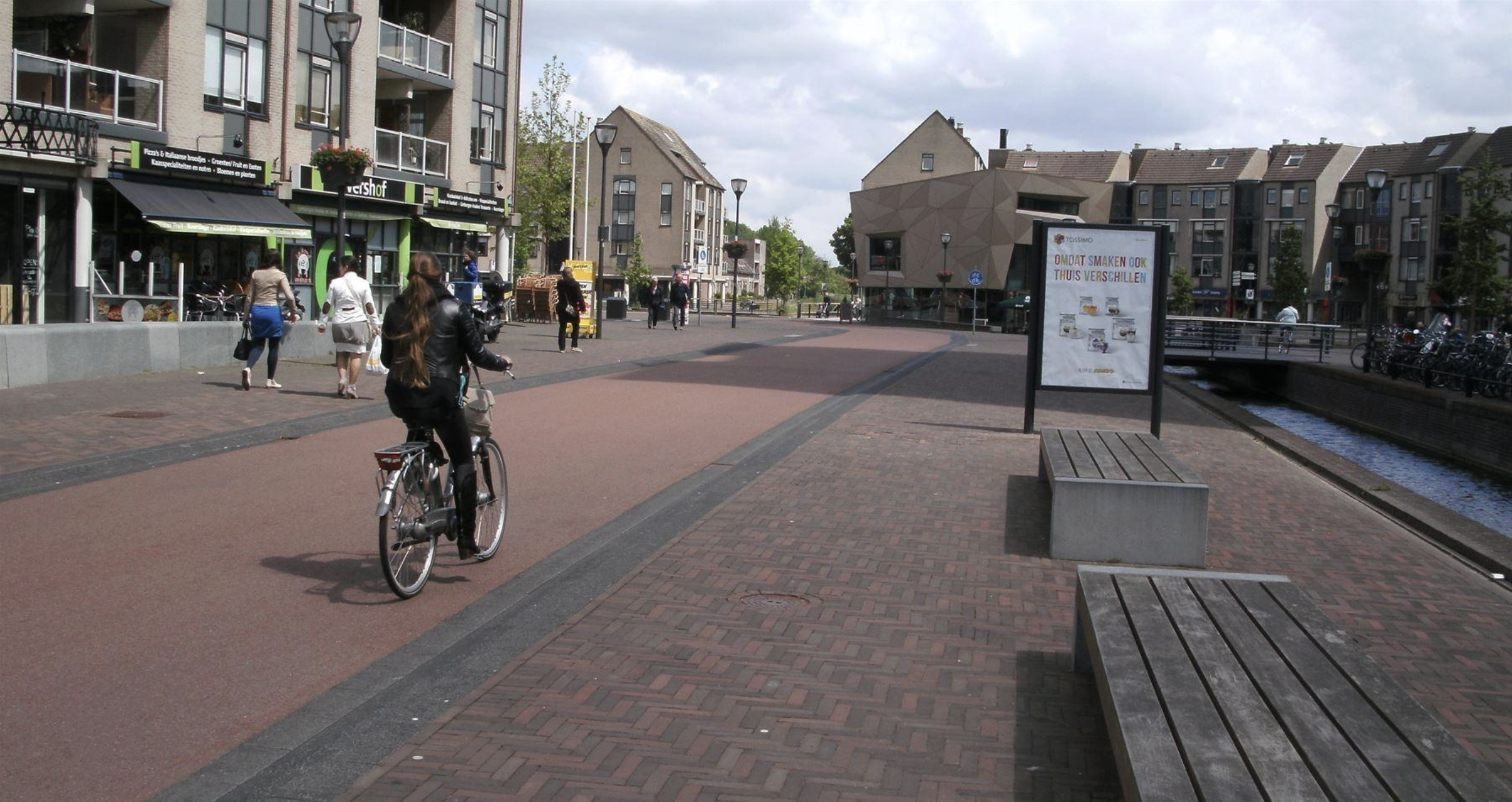
Houten, Netherlands
Mobility before cars: cycling routes are direct, safe, and central to everyday neighbourhood life.
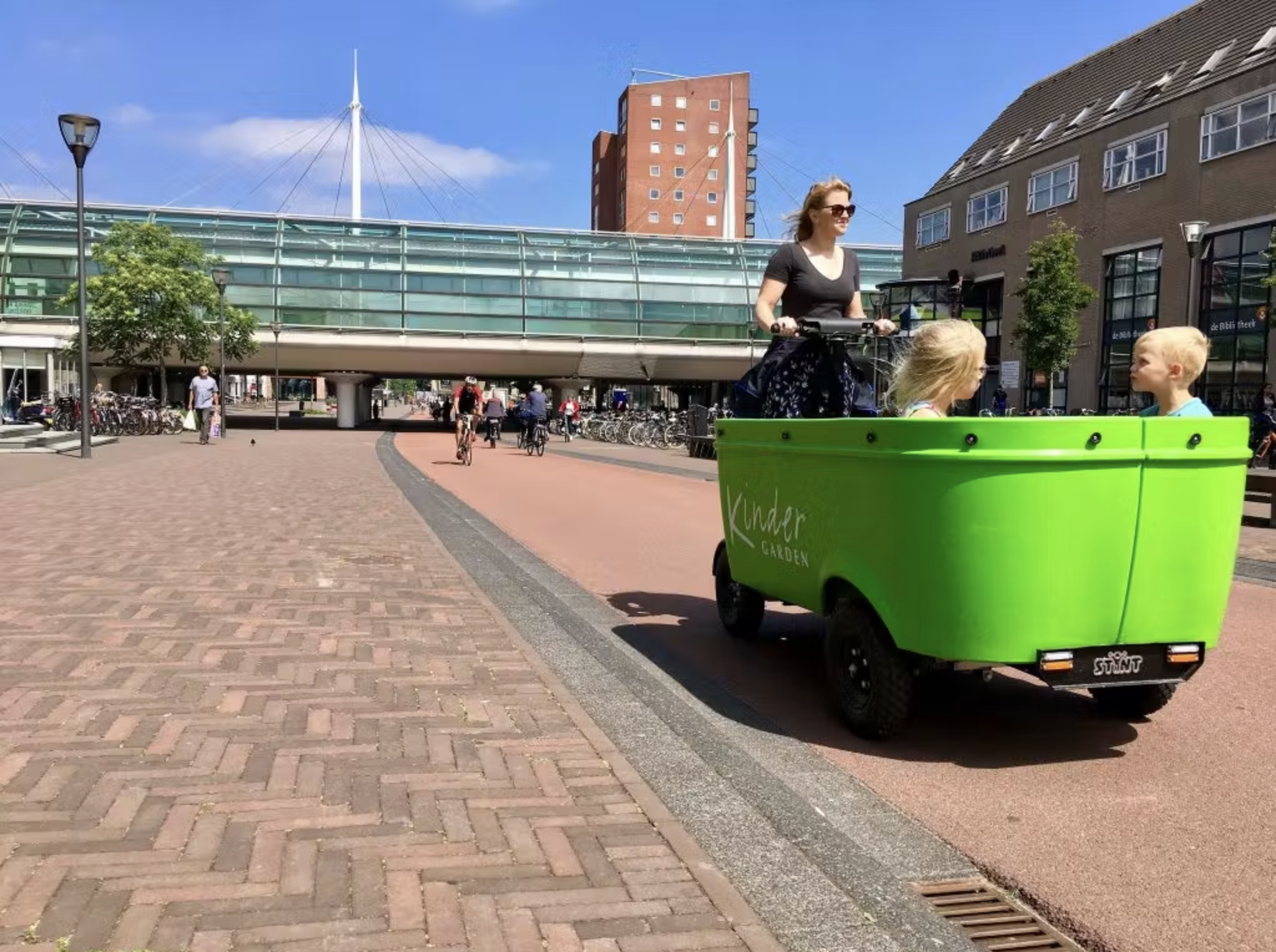
Houten: everyday life
A planned town where mothers, children, and elders can move around safely and comfortably.
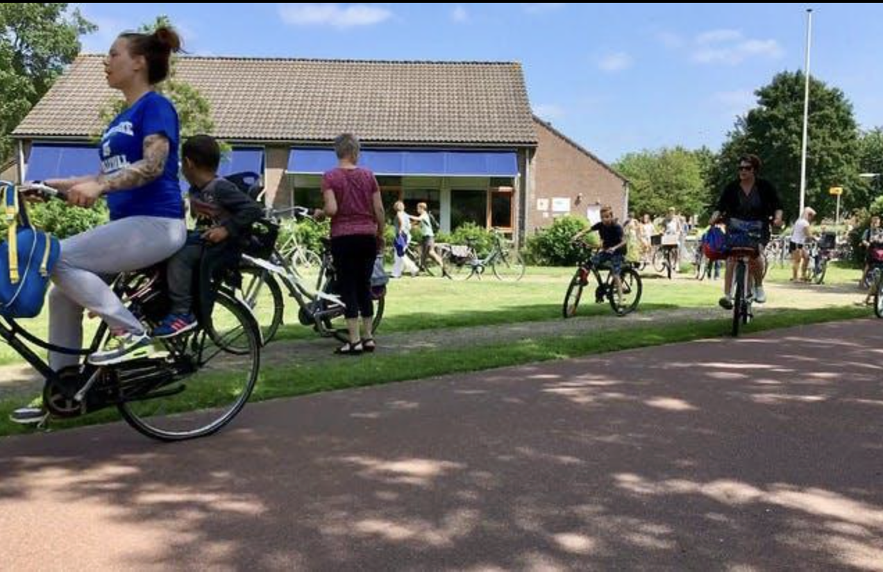
Houten: child-safe mobility
A strong neighbourhood allows children to move safely without depending on adults driving them.
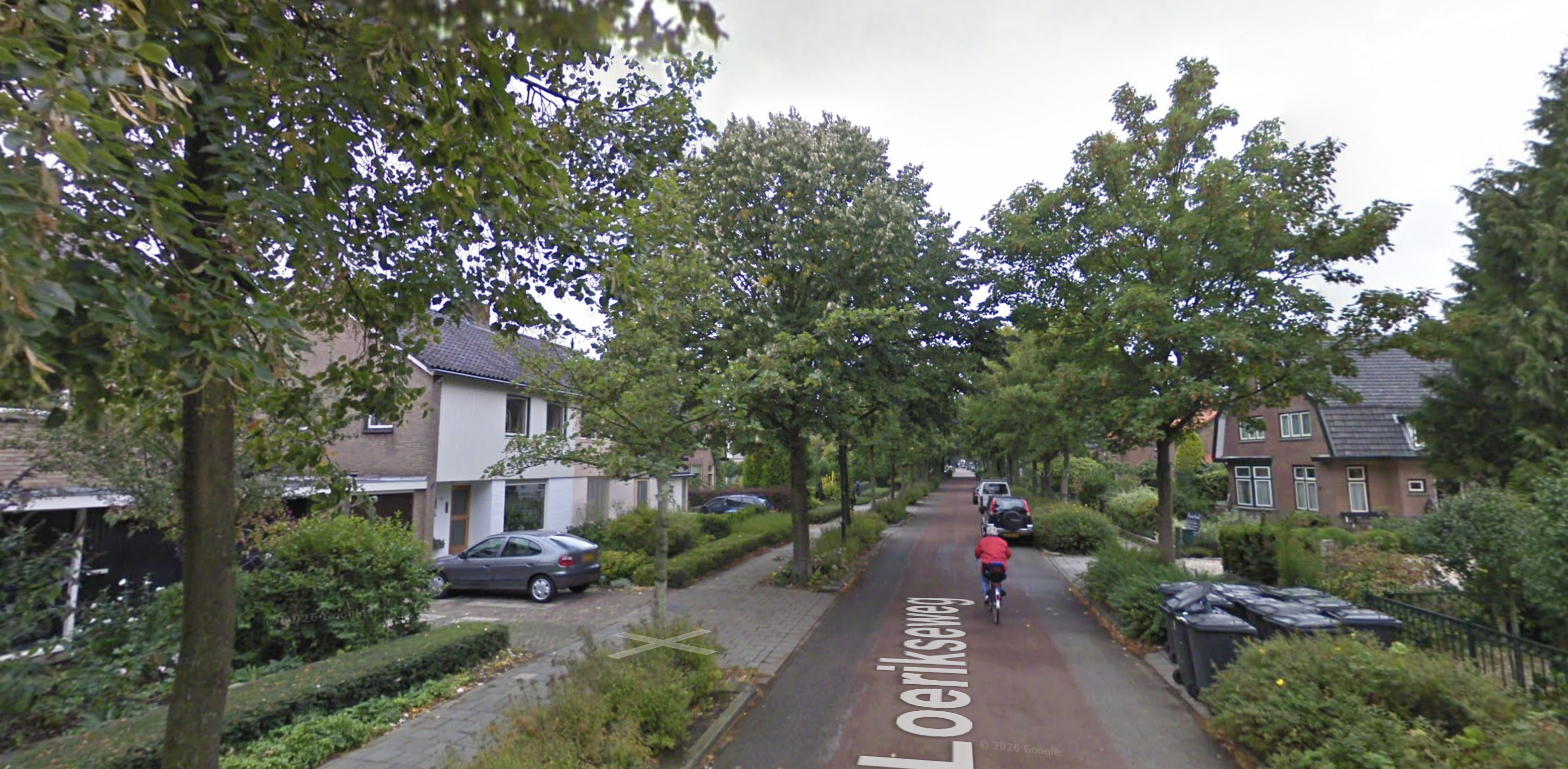
Houten: homes and streets
Housing, greenery, and local streets are planned together as one coherent neighbourhood system.
Houten: daily needs nearby
World-class planning connects homes, shops, schools, and services with safe walking and cycling access.
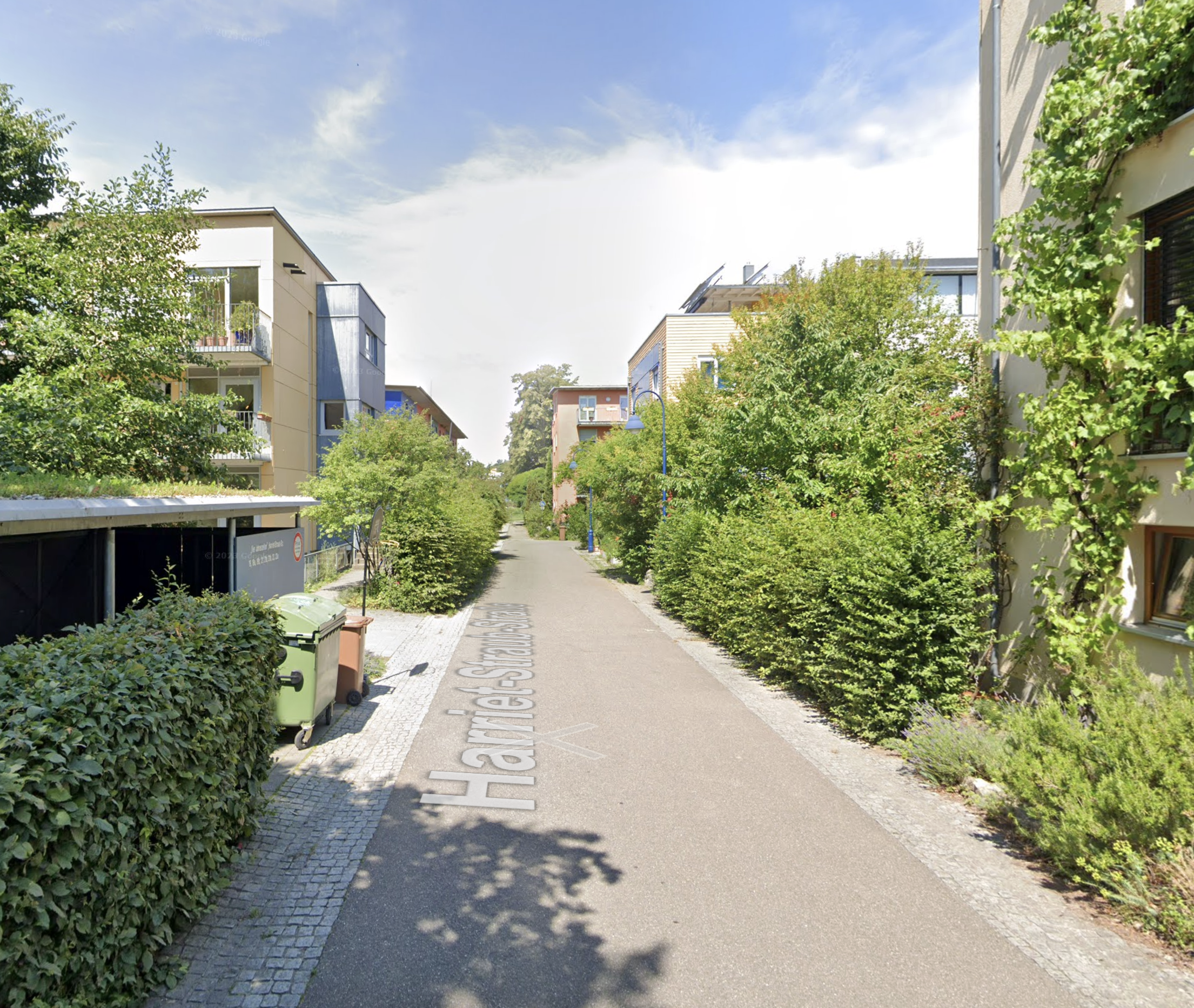
Freiburg: buildings and public realm
Good neighbourhoods depend on how buildings shape the street, public space, and human comfort.
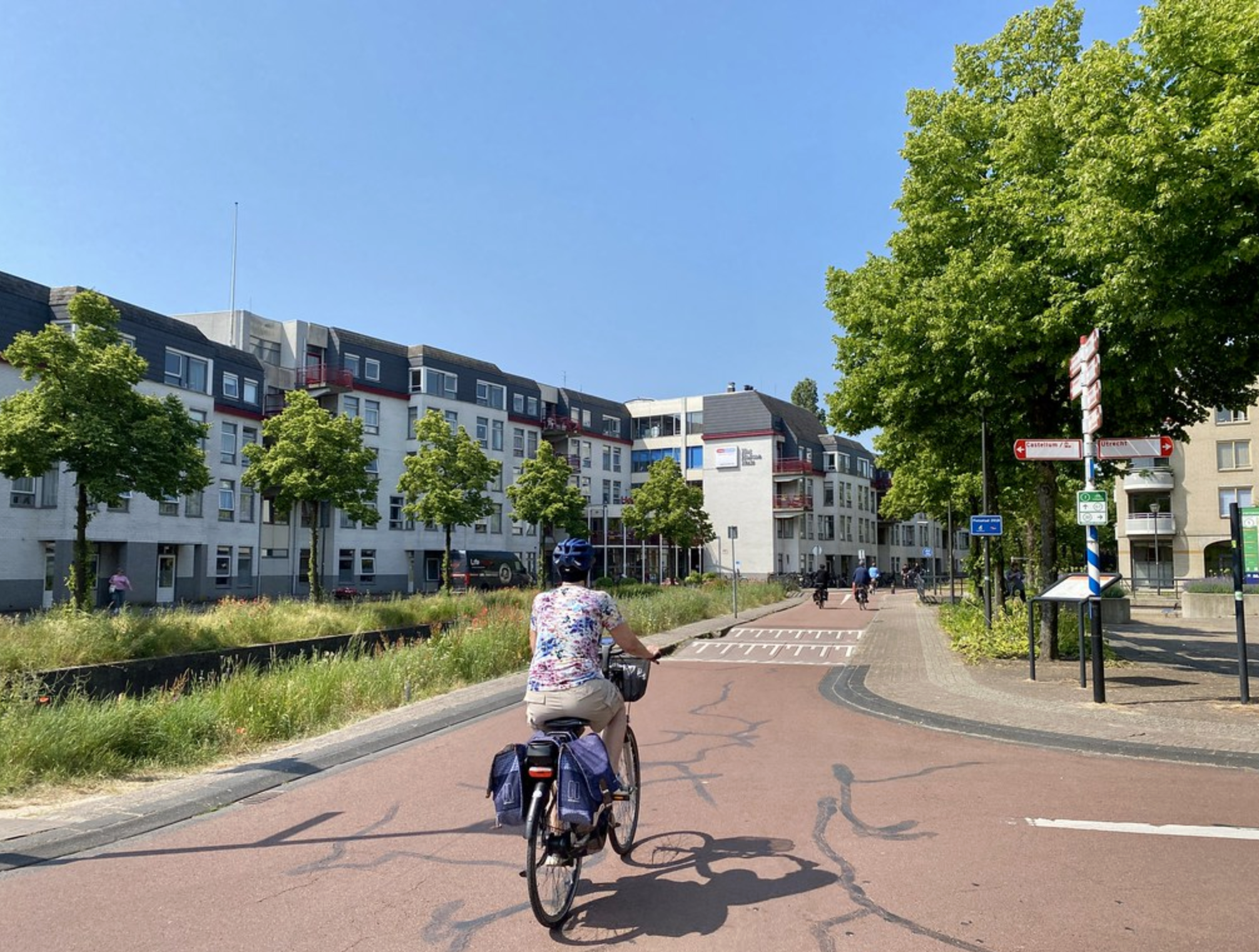
Freiburg: cycling network
Car-light living works when cycling routes are continuous, visible, and integrated into daily life.
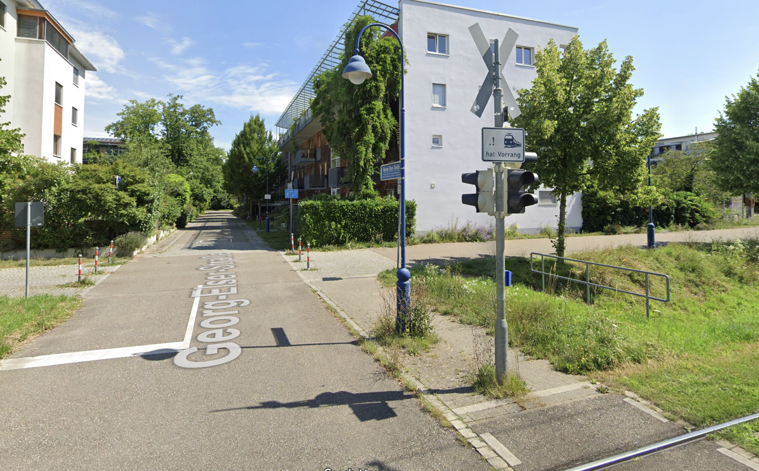
Freiburg: safe crossings
Good crossings are visible, frequent, and located where people naturally need to cross.
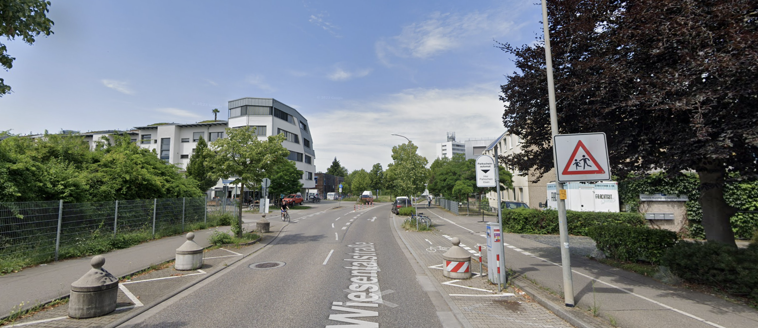
Freiburg: calm streets
Streets are not only traffic corridors; they shape safety, shade, noise, and public life.
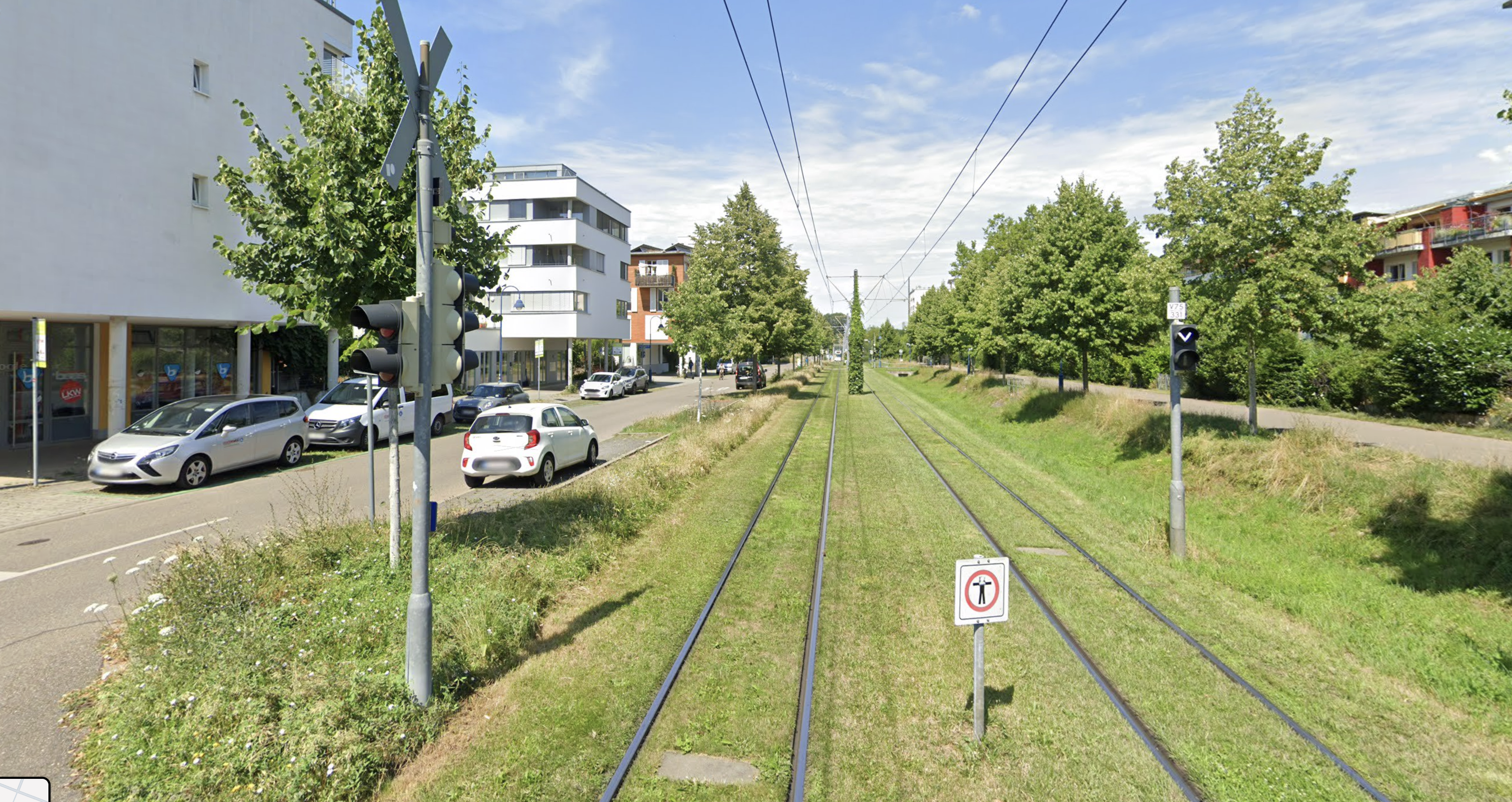
Vauban, Freiburg
Public transport is built into the neighbourhood, making tram access part of everyday living.
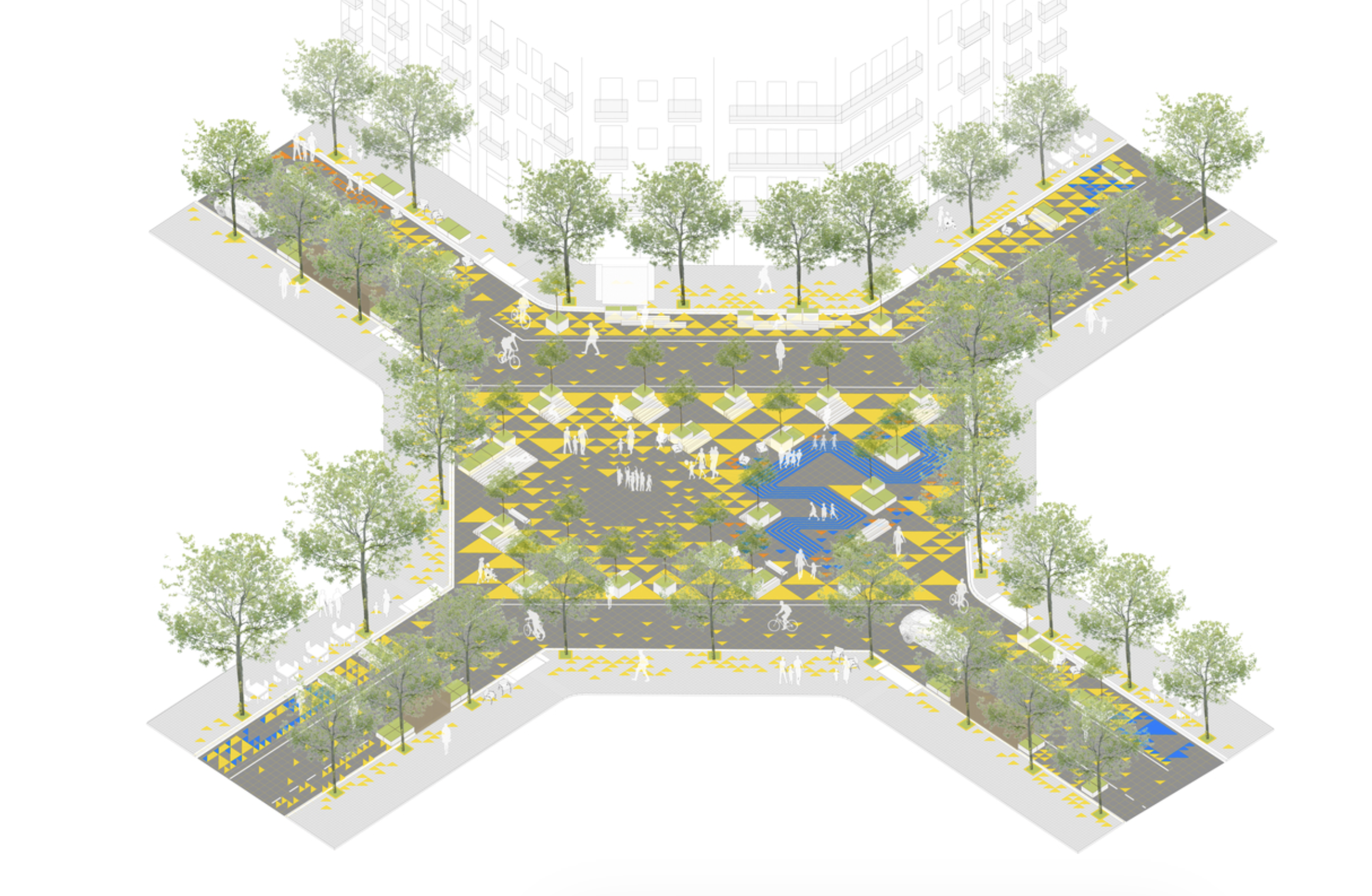
Barcelona Superblock
A street can become a public place when traffic is reduced and space is returned to people.
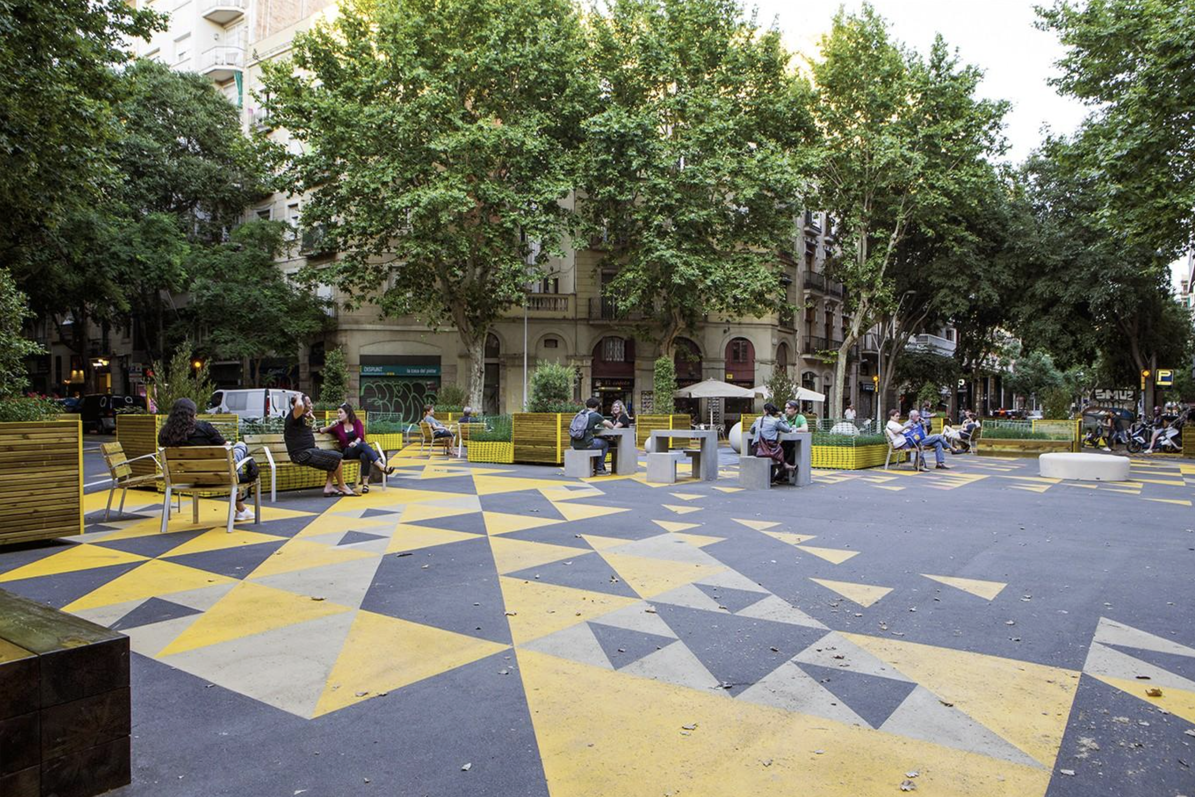
Superilla Sant Antoni
Benches, shade, planters, and slower streets turn road space into social and civic space.
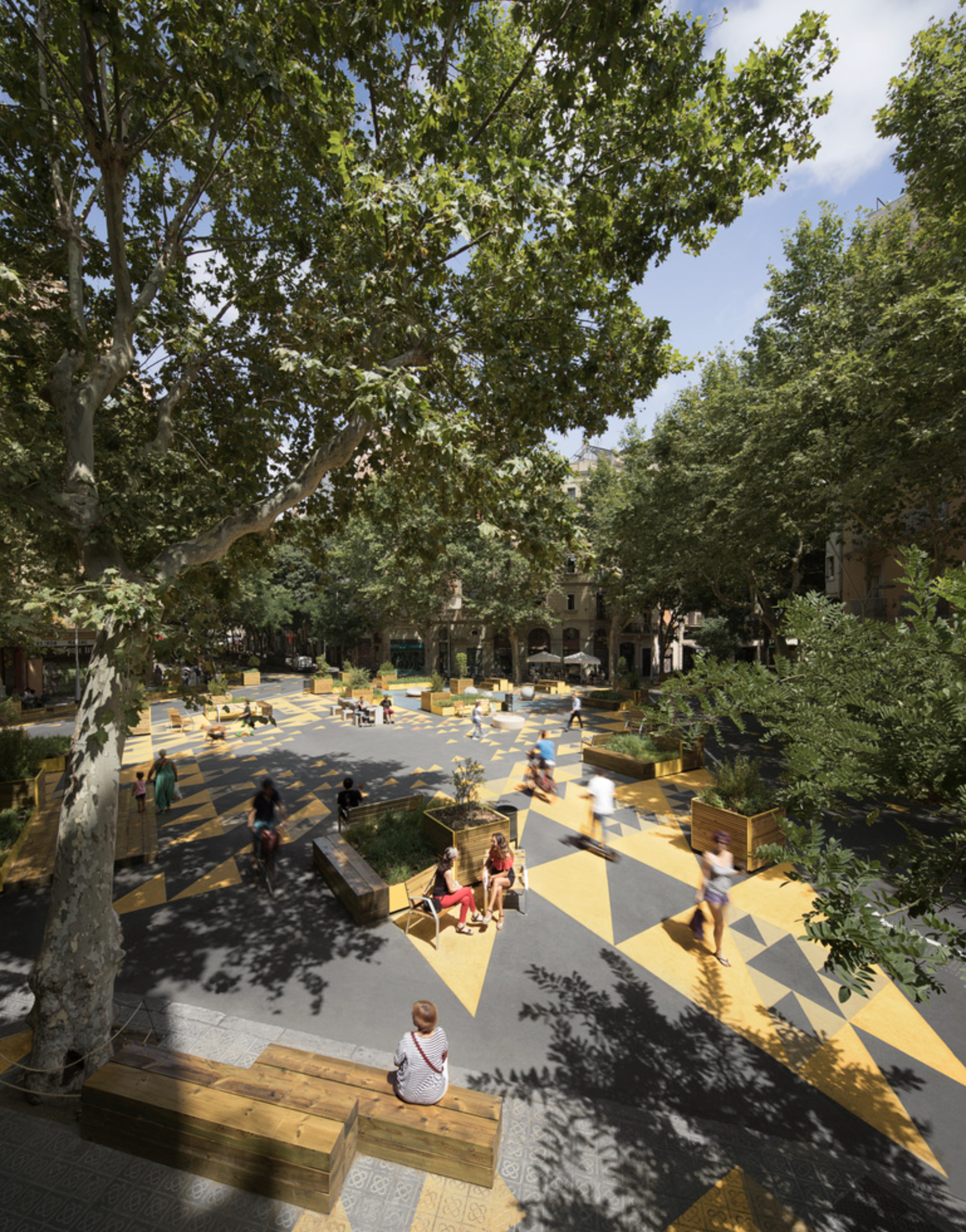
Superilla Sant Antoni: seating
Public seating changes the street from a place to pass through into a place to stay.
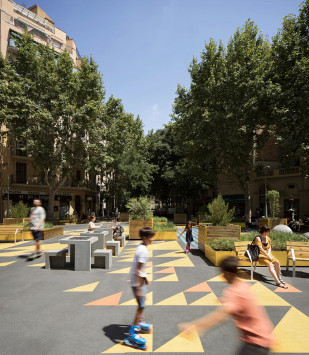
Superilla Sant Antoni: children and play
A world-class street is safe enough for children, elders, families, and everyday public life.
Conclusion
I began this post with one question:
Does the city work as a living system for ordinary people?
After walking through Boat Club, Anna Nagar, T. Nagar, and Velachery, the honest answer is: not yet, but it could.
Each neighbourhood gave a different answer to why. Boat Club showed that wealth is not a public system. Its shade, calm, and beauty are inherited and private, while the river, the reservoir, the sewer, and the floodplain that decide its fate belong to no single accountable authority. Anna Nagar showed that a plan is not a planning system. The best layout Tamil Nadu ever built is being dismantled one legal approval at a time, because the five-yearly review the 1971 Act demands has never once been performed. T. Nagar showed that a law is not enforcement, and a project is not an operation. The city’s most valuable streets carry its weakest enforcement, and its finest pedestrian plaza was inaugurated and then abandoned to entropy. Velachery showed that a land-use map is not hydrology. A city can rezone a marsh on paper, but it cannot rezone where water goes [22].
Four neighbourhoods, four origins, one operating system. And the same six connections missing every time: planning, finance, engineering, maintenance, enforcement, and democratic accountability, never joined under one answerable authority. This is the same finding NITI Aayog reached at the national scale: fragmented authority, plans treated as one-time drawings, weak capacity, and poor coordination [59].
This confirms the argument of my earlier works on South Indian towns. Chennai is not falling short because of population growth or lack of money. Chennai has more money, more engineers, more institutions, and more political attention than any other city in Tamil Nadu. What it lacks is the unified accountability and enforcement. The CMDA plans, the GCC maintains, the WRD manages water, the CMWSSB manages sewage, the Highways Department builds roads, and no one is answerable for whether the neighbourhood works as a whole. A drain that is planned by one agency, built by another, and maintained by no one is not infrastructure. It is a contract.
The thinkers I have carried through this series all point to the same discipline. Geddes asked us to survey before we plan [38]. Koenigsberger asked us to plan from climate outward, from heat, rain, and flood, not from imported forms. Jacobs asked us to judge streets by the everyday public life they produce [40], and Gehl by whether they invite people to stay [41]. Alexander asked us to protect the living patterns, the shaded street, the garden plot, the corner shop, that make a place work [39]. Roy warned us that informality is manufactured by the state itself, through exception and selective enforcement, for the rich as much as the poor [75]. Chennai’s four neighbourhoods are case studies in ignoring all of them at once.
But I want to end where I ended the Tirunelveli study: these failures are solvable and fixable.
Nothing in this post requires a technology Chennai does not have or money Chennai cannot raise. Copenhagen mapped its flow paths after one cloudburst and rebuilt its streets as drainage [49]. Barcelona reclaimed a 3x3 grid of blocks and gave it to people, and both well-being and local business rose. Houten planned for the child on a cycle, and then kept planning as it grew. These are not miracles. They are administrative decisions, made once and then maintained as permanent civic discipline.
The Third Master Plan (2026–2046) is Chennai’s opening to make that decision [23]. Its test is simple, and it is the test this whole post has applied. Will it be another land-use map, or will it become a delivery system? Will it notify the Adyar floodplain and the Pallikaranai marsh into law? Will it create basin authorities that match the water map instead of the department map? Will it keep the statutory five-year clock for the first time in fifty years? Will it publish the numbers, drain dimensions, desilting records, tree canopies, flood registers, so that maintenance becomes measurable and lapses become attributable? A master plan is not an event. It is a subscription, and Chennai has to start paying it.
I still remember arriving in Chrompet fresh out of high school, sharing a room with working men, taking the local train to Chennai Beach. The city gave me freedom before it gave me anything else. That is what a city is for. Not for the wealthy, the car-owning, or the politically connected, but for the student with a black-and-white phone, the vendor on Ranganathan Street, the elder crossing Second Avenue, the family in Velachery raising their plinth one more time and hoping.
Chennai already has the plans, the engineers, the money, and the memory of every flood. What it needs now is one answerable system that connects them. The day Chennai joins planning, finance, engineering, maintenance, enforcement, and accountability under authorities that match its watersheds and its neighbourhoods, it will not need to imitate Houten or Barcelona. It will be the benchmark other cities walk through and wonder about.
The day Chennai merges planning, finance, engineering, maintenance, enforcement, and accountability under authority that matches climate conditions and watersheds; It will become the benchmark other cities. Chennai can become one of the great urban examples of the twenty-first century, as it has resources, engineers to execute this.
References
Footnotes
Illustrative comparison; a plot-level density calculation for the original TNHB layout versus Vauban’s ~90 dwellings/ha would be a useful addition and does not, to my knowledge, exist in published form.↩︎
Standard runoff coefficients put a plot with garden, unpaved margins, and open well at roughly 0.3–0.5 versus 0.8–0.95 for a fully built-over plot with paved setbacks; a measured pre/post coefficient study for Chennai plot typologies is a gap in the literature worth flagging.↩︎